| GPS | N37 16.95 W118 09.03 |
| Elevation gain | 7,200-11,400 |
| Season | April-November |
| Terrain | Highly graded washboard |
| Difficulty | Easy |
| Required Vehicle | Subaru friendly |
| Time | 2 hours |
| Length | 12.3 miles |
Phone 760 873-2501 for current road conditions.
Directions: From Big Pine travel east on Highway 168 for 13 miles. Turn left at the signed junction for White Mountain Road to the Bristlecone Pine Visitor Center and continue 10 miles until the end of the paved road at Schulman Grove. Turn right for the Schulman Grove Visitor Center parking lot. The Visitor Center provides interesting information about the Bristlecone pines along with a scenic hiking trail; The Methuselah Trail. The center is open 10:00 am to 4:00pm Friday-Monday. Monday and Friday only in October. It closes Nov. 2nd for winter.
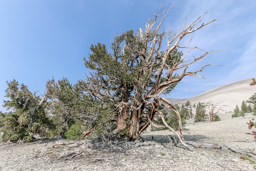
Site Location and Description: The White Mountains are located on the west side of the Owens Valley east of Bishop and are home to the Bristol Pine, thought to be the oldest living trees. One of these trees can be found along the Methuselah Grove hiking trail which starts from the visitor center at 9,846 feet and makes a 4.5-mile loop that includes the side valley of the Methuselah Grove where the oldest tree lives. Numbered natural-history markers are explained by a booklet. The Methuselah Grove in the Ancient Bristlecone Pine Forest is the location of the “Methuselah” (Methuselah is the name of a man reported to have lived the longest at the age of 969 in the Hebrew Bible.), a Great Basin Bristlecone Pine that is 4,847 years old. For many years, it was the world’s oldest known living non-clonal organism, until superseded by the discovery in 2013 of another bristlecone pine in the same area, with an age of 5,065 years (germination in 3051 BC). “Methuselah” is not marked in the forest, to ensure added protection from vandals. (source: https://en.wikipedia.org/wiki/Ancient_Bristlecone_Pine_Forest)
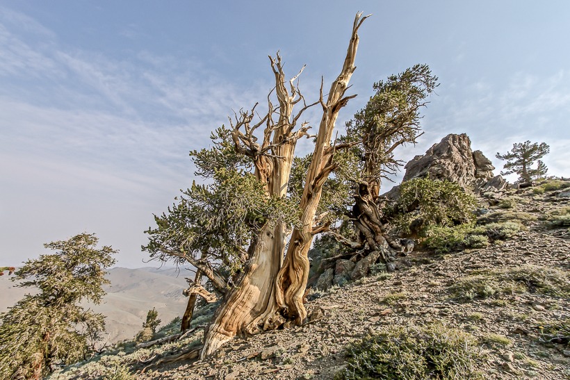
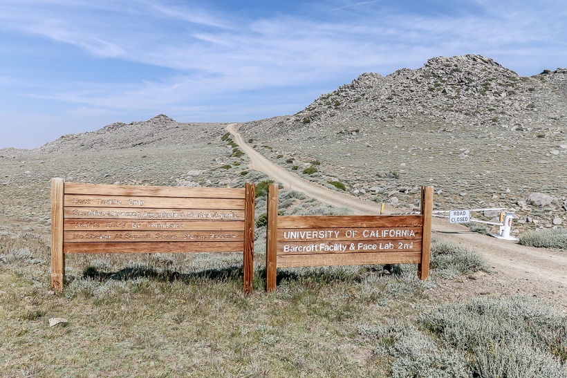
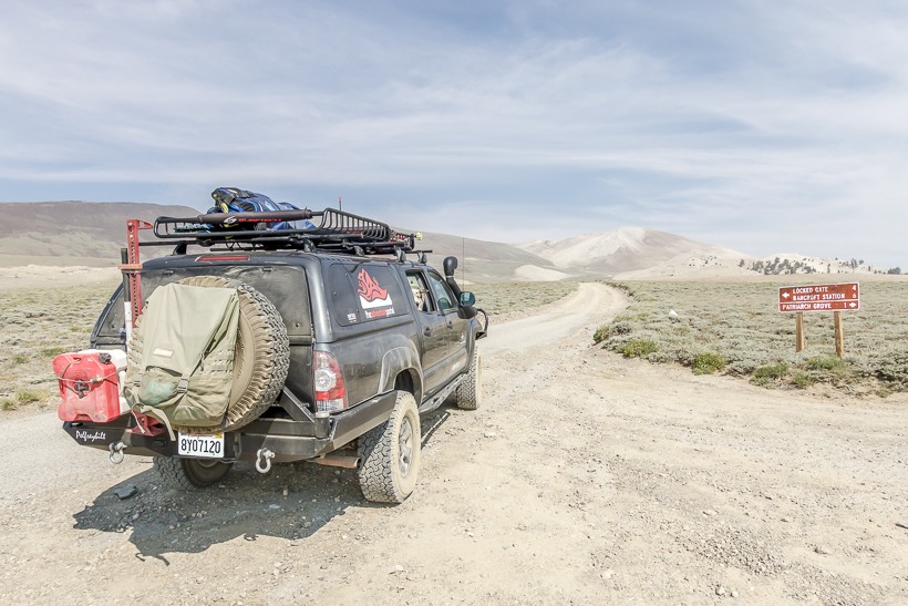
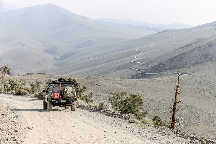
Beyond Schulman Grove, lies the Patriarch Grove. This second grove is a 12-mile drive north of the Schulman Grove visitor center on a good quality, graded dirt road. Be prepared for your vehicle to do the, “washboard rattle”! The road between Schulman Grove and Patriarch Grove traverses the White Mountain range and provides stunning views of California’s Owen’ Valley and the Sierra Nevada mountains to the west. Once you near tree line, you come to Patriarch Grove, home of the world’s largest Bristlecone Pine, the Patriarch Tree. Bristlecone pines and limber pines dot the landscape with a background view of the Great Basin in Nevada. Most people stop here but the trail goes on for several miles into the White Mountains before ending at a locked gate marking a University of CA research center .
High Clearance 4×4 trails: There are two trails that split from the main trail; Silver Canyon Trail and Wyman Canyon Trail. Both are worth exploring with the proper vehicle. Do not attempt without 4×4 and high clearance.
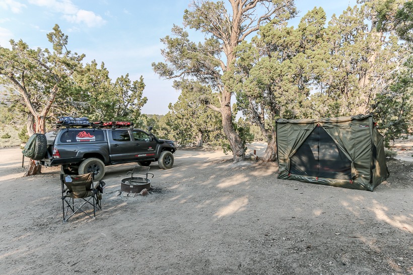
Camping: There is an excellent dry campsite at around 8,000 ft. called Grandview Camp. A great spot for star gazing.
The History of White Mountain Road: In the 1950’s Dr. Edmund Schulman of the University of Arizona used the bristlecone trees on White Mountain to study climate change. Because of their long life, their growth rings they provided a good historic record of the amount of yearly rain in the area. Dr. Schulman also discovered the oldest living tree and named it the Methuselah Tree. It stands in a grove named after Dr. Schulman.

There is a Mexican Mine just south of Schulman Grove that operated sporadically for the mid 1800’s-early 1900’s. Small amounts of silver, lead and zinc were extracted. A few of the mining cabins can still be seen today.
Wyman creek flows through a canyon that cuts through the White Mountains to the east. It was named after Dan Wyman, who prospected for gold in the area in 1861. The first communications line to the Nevada goldfields from the west crossed the White Mountains up Silver canyon and down Wyman Canyon.