Home Blog Page 71

Cleveland National Forest-Los Pinos Trail

View to Mexico from top of Los Pinyos Trail
View to Mexico from top of Los Pinos Trail
GPS N 32 43.50′  W116 33.50′
Elevation 2,800-4,900
Season Year round. Very hot in summer. Best in dry weather
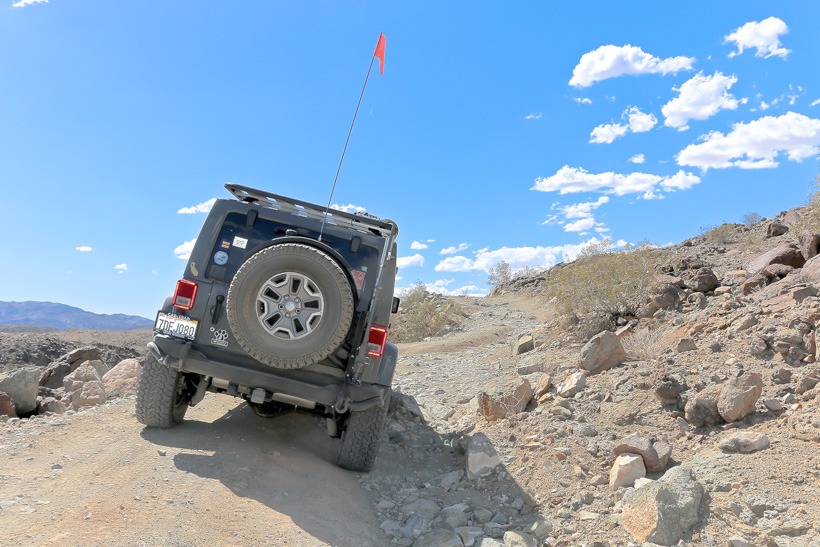
Terrain Rough shelf roads, can be slippery after rains
Difficulty Easy to Moderate
Required Vehicle  Designated OHV area. Stock 4×4 may be challenged.
Time 3 hours: loop trail
Length 18.6 miles. 17.7 unpaved
Most difficult section of Los Pinyos Trail
Most difficult section of Los Pinos Trail

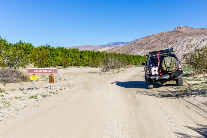
Directions: The Los Pinos trail is located 50 miles east of San Diego and south of I-8.  It starts at Coral Canyon Road, at the Four Corners Trailhead, 5.6 miles west of Buckman Springs Road and is a loop trail.

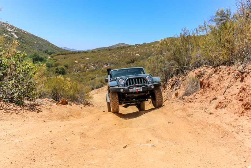
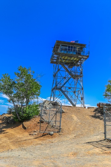
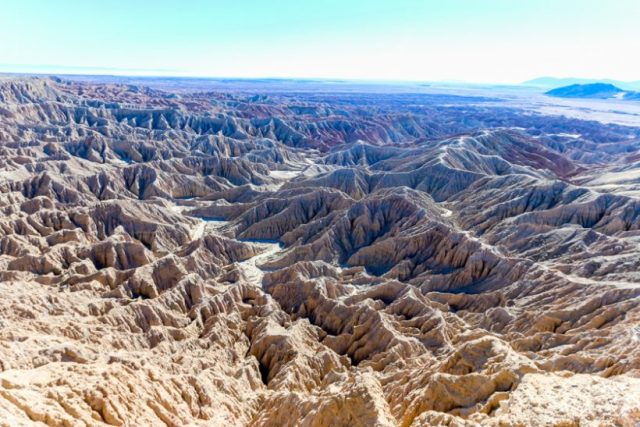
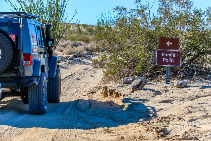
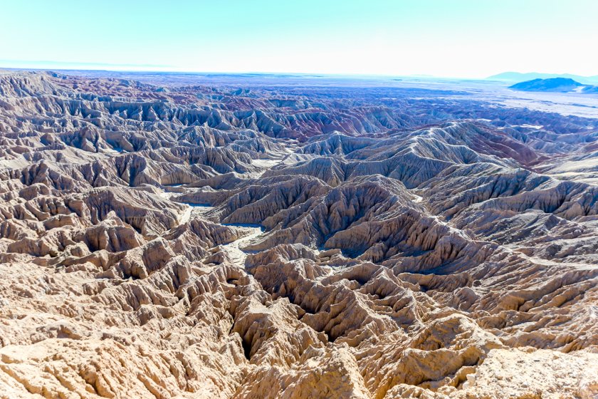
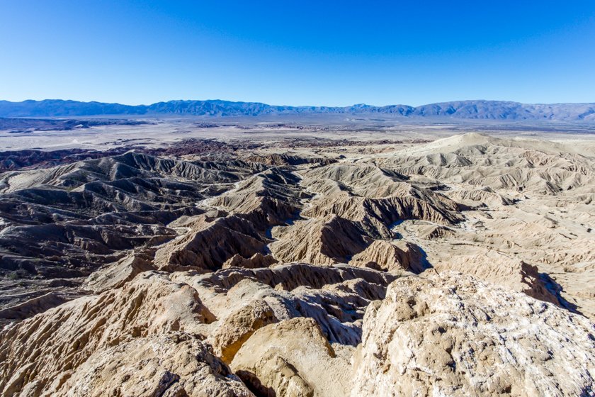
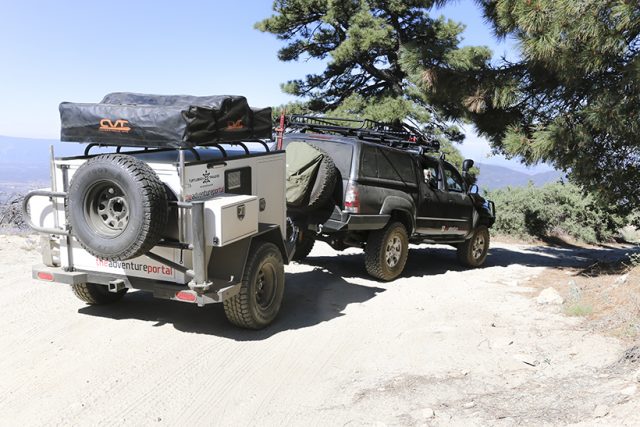
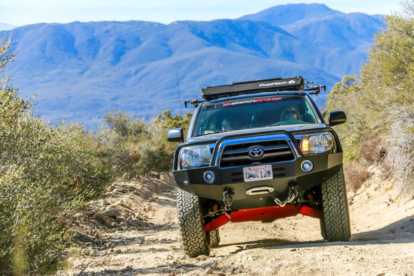
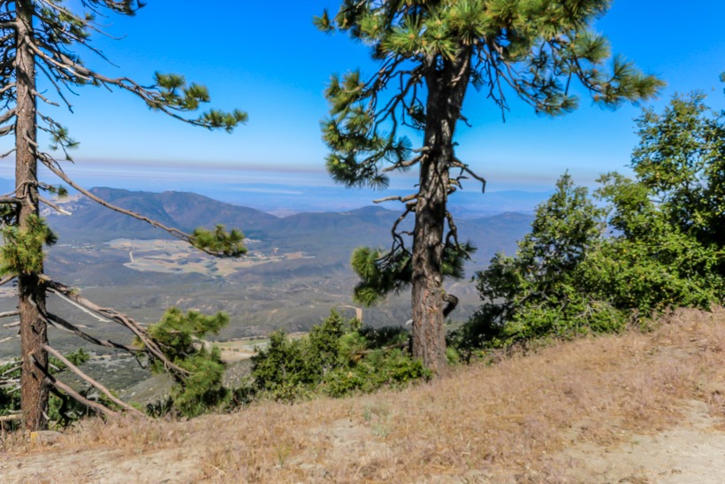
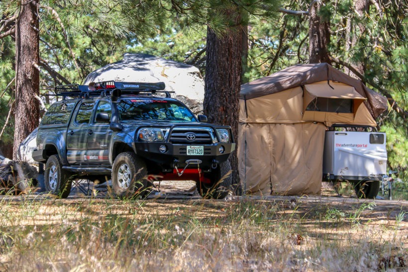
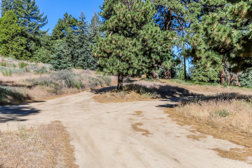
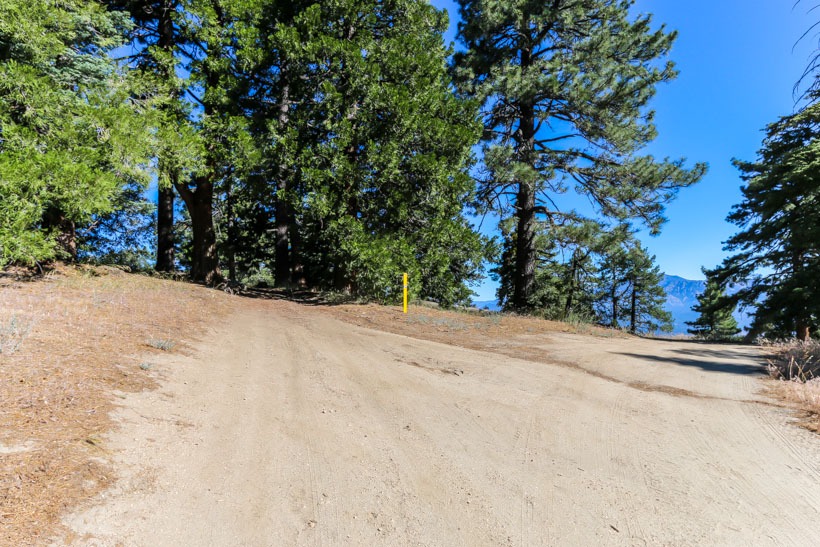
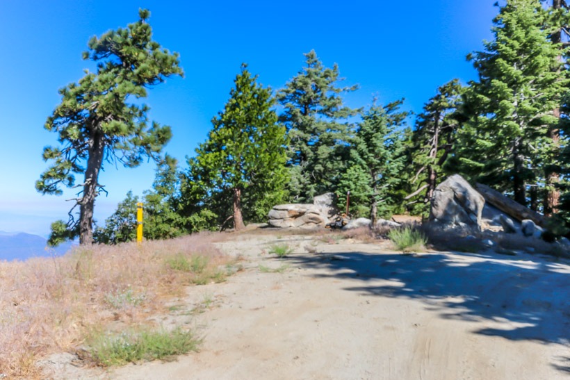
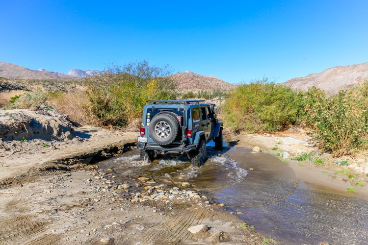
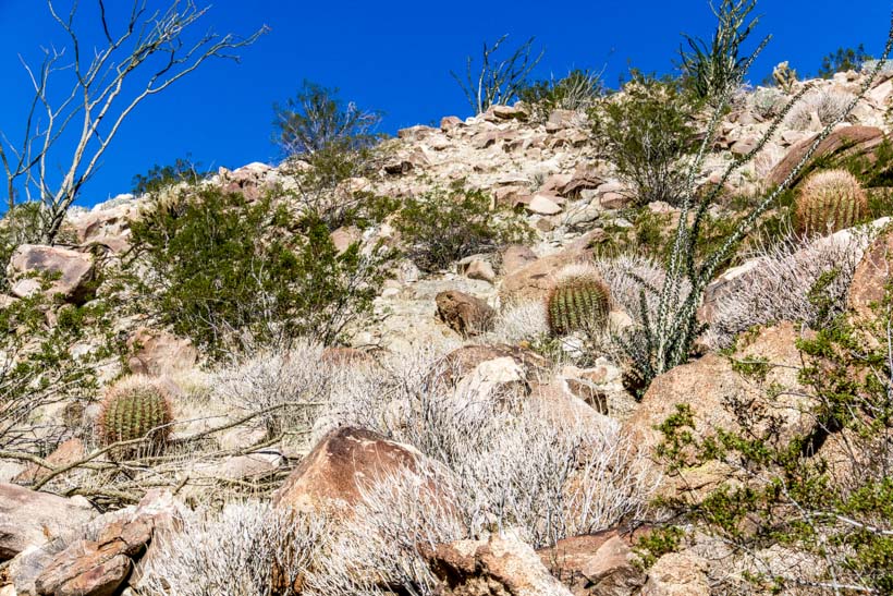
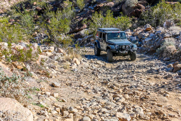
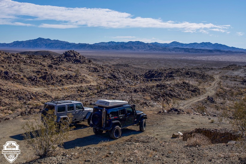
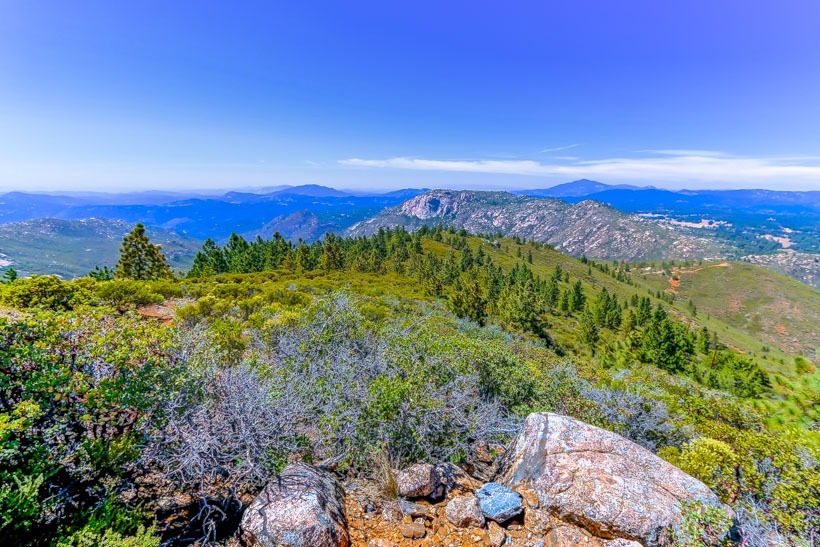
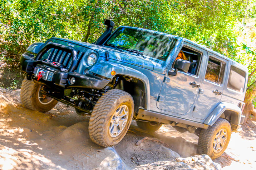
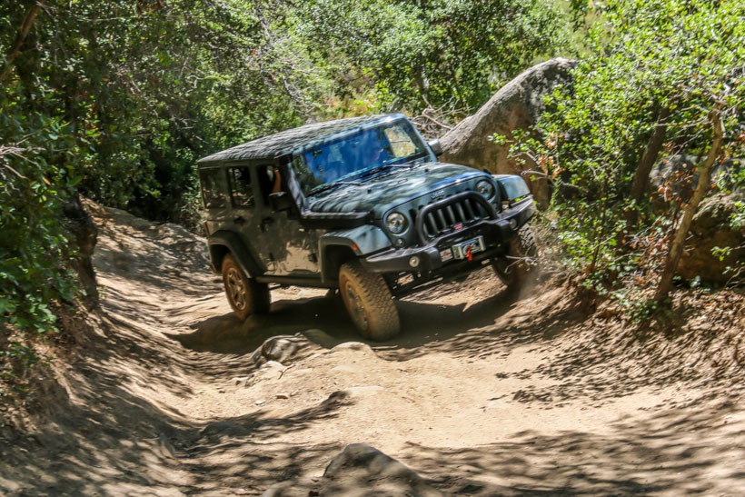
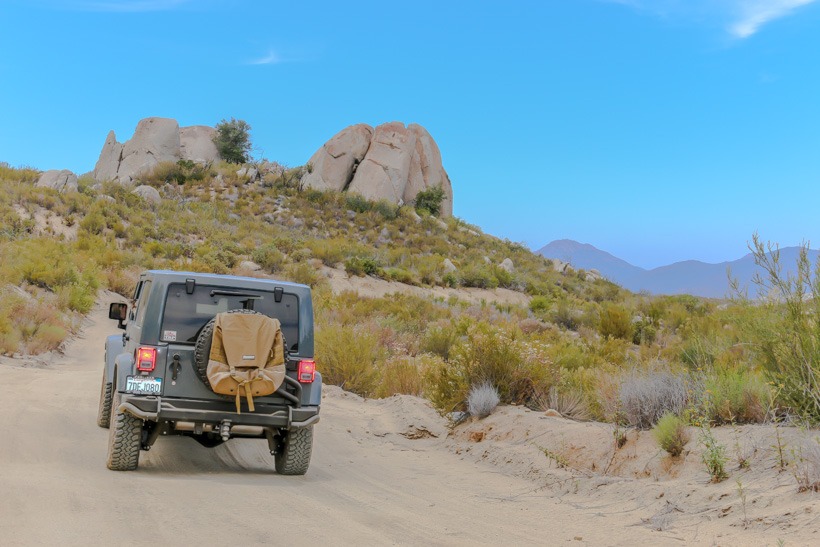
Site Location and Description: The Los Pinos Trail is is a designated 4WD trail that loops around a granite boulder landscape near Corral Canyon and Lake Morena. The trail can be traveled in either direction and is rated moderate due to the Espinoza Trail section that runs down Espinosa Creek. This section of the loop can be very rough and uneven. Which direction you head will determine a descent or ascent of this difficult rough and uneven boulder strewn area. After completion of this section, the rest of the trail is fairly easy. When you get to the top of Los Pinos mountain, see if the lookout tower is open.  The views are amazing and the volunteers who man the tower have a  lot of knowledge about the area.  Be sure to stay on the designated trail, as it borders both the Pine Creek and  Hauser Wilderness Areas. This is a good day trip with beautiful and rugged terrain.

Rubi on the Los Pinyos Trail
Rubi on the Los Pinos Trail

The History of Los Pinos Trail: The Luiseno and Cahuilla tribes were the first occupants of the Los Pinos region. In  1769, Junipero Serra traveled through the area and established a Mission in San Diego.  The Cleveland National Forest supplied most of the wood used to build many of the California missions.  The Native Americans kept the land in this area fertile with regular burnings of the brush land.  During the 1800’s the land was parceled into land grants and was used for ranching.  Overgrazing and timber cutting heavily taxed the environment which still hasn’t fully recovered. 

Click here for more CA off-road, Overlanding trails…..and TAP into Adventure!

Southern end of Los Pinyos Trail
Easy southern end of Los Pinos Trail

Climbing up to the Lookout Tower

Top of Los Pinyos Trail
Top of Los Pinos Trail

Fire Look out trail Los Pinyos Trail
Fire Look out trail Los Pinos Trail

Click here for more CA off-road, Overlanding trails…..and TAP into Adventure!

Fonts Point – Anza Borrego DSP

Fonts Point, Anza Borrego DSP, Anza Borrego off-road trails, overlanding, overland, over land, California overland trails, off-road, off-roading, offroading, vehicle supported adventure, desert adventure,
Entry to Fonts Point- Anza Borrego Desert State Park
GPS N33 18.205 W116 14.346
Elevation  717 ft. to 1,250 ft.
Season Year round: best Oct.-May
Terrain Packed dirt, deep sand in places, washboard: flash floods are a possibility
Difficulty Easy terrain/soft sand can be a challenge
Required Vehicle 2 or 4 wheel drive. With stock tires it’s better to air down a bit in the soft sand.
Time 1/2 hour each way
Length 4 miles each way
Fonts Point, Anza Borrego DSP, Anza Borrego off-road trails, overlanding, overland, over land, California overland trails, off-road, off-roading, offroading, vehicle supported adventure, desert adventure,
Anza Borrego State Park-Trail marker Font’s Point

Fonts Point, Anza Borrego DSP, Anza Borrego off-road trails, overlanding, overland, over land, California overland trails, off-road, off-roading, offroading, vehicle supported adventure, desert adventure,
The Adventure Portal team entering Font’s Point-Anza Borrego State Park

Site Location and Description: This is one of the most popular viewpoints in Anza-Borrego Desert State Park. It is located east of the Visitors Center between County Road S-22 and Route 78 overlooking the Anza Borrego Badlands. The formations here tell a 4 million-year story of geologic and paleontological history. Conglomerates, sandstones, claystones and mudstones, compressed and hardened, chronicle a variety of landscapes, fossil life forms and climates that no longer exist at Anza-Borrego. It is truly spectacular. You need to walk up a slight rise to get some great panoramic views of Anza-Borrego State Park encompassing the Borrego Badlands. You will see the Vallecito Mountains, the Borrego Valley with its washes, eroded canyons, the oasis of Borrego Springs, the Peninsular Range, Borrego Buttes and the Pinyon Mountains. This is a tremendous and popular veiwpoint.

Directions: From Borrego Springs, take highway S22 east for approximately 11 miles.  There will be a sign near mile marker 29. From the Salton Sea, take S22 west approximately 17 miles.

Fonts Point, Anza Borrego DSP, Anza Borrego off-road trails, overlanding, overland, over land, California overland trails, off-road, off-roading, offroading, vehicle supported adventure, desert adventure,
Font’s Point looking east over the Badlands at Anza Borrego State Park
Fonts Point, Anza Borrego DSP, Anza Borrego off-road trails, overlanding, overland, over land, California overland trails, off-road, off-roading, offroading, vehicle supported adventure, desert adventure,
Font’s Point looking west-Anza Borrego State Park

The History of Fonts Point: More than 200 years ago, the Spanish explorer Juan Baustista de Anza passed Font’s Point leading a band of men, women and mules northward to Monterey, California. The path he forged through the desert followed San Felipe Wash. Father Pedro Font, who served as official chaplain, diarist and observer on Anza’s expeditions of 1775-76, described this vantage point of the Borrego Badlands later named for him as the “sweepings of the earth.”

One and a half to 6 million years ago, Anza-Borrego was a receiving basin for the Colorado River while it carved out the Grand Canyon. Earlier, delta-marine waters of the northern Gulf of California covered the area. Organic deposits settled and shifted as mountains rose. All of this movement leaves us with a treasure trove of many ancient land mammals buried in the sedimentary layers of rock, conglomerate and dried mud as well as thousands of acres of canyons and dry washes to drive through, hike through and explore. Sedimentary rocks contain enough side canyons and dry washes for a lifetime of adventurous exploring.

Fonts Point, Anza Borrego DSP, Anza Borrego off-road trails, overlanding, overland, over land, California overland trails, off-road, off-roading, offroading, vehicle supported adventure, desert adventure,
Font’s Point information marker-Anza Borrego State Park

Link to: Anza Borrego Desert State Park

Click here for more CA off-road, Overlanding trails…..and TAP into Adventure!

Thomas Mountain Trail: Santa Rosa Mountains

Thomas Mountain Trail, overland, over landing, overlanding, over land, offroad, off-road trails, off-roading, overland adventure, overland expedition, vehicle supported adventure, overland trails, california overland trails,

Thomas Mountain Trail, overland, over landing, overlanding, over land, offroad, off-road trails, off-roading, overland adventure, overland expedition, vehicle supported adventure, overland trails, california overland trails,

GPS  N 33.6220    W116.6772
Elevation 6,825
Season Year round: Potential for snow in winter
Terrain Packed dirt,  some washboard, ruts, small rocks.
Difficulty Easy
Required Vehicle High clearance 4 wheel drive best
Time 1 1/2 hour loop
Length 14.5  miles loop

Directions to Thomas Mountain Trail: From the South: take I-15 north then HWY-79 south to HWY 371: turn left and follow for 20 miles up into the mountains.  You will come to a t-junction at HWY-74 go left. Thomas Mountain Trail is a dirt off-road trail, sign posted on your left before you reach Lake Hemit.

Thomas Mountain Trail, overland, over landing, overlanding, over land, offroad, off-road trails, off-roading, overland adventure, overland expedition, vehicle supported adventure, overland trails, california overland trails,
Slow climb up Thomas Mountain

Site Location and Description:  Thomas Mountain Trail is an over land packed dirt trail that winds up Thomas Road to the summit.  It is a fun and fairly easy overlanding trail that winds through oaks and pinyons, to grassy meadows, then tall pines and cedars, with fir trees at the highest elevations. There are a couple of developed campgrounds at the top, with tables and toilets, and 9 offroad primitive “yellow post’ campsites. Yellow post means that you can have campfires as long as the fire stays within the designated fire ring and as long as fire restrictions allow.  Thomas Mountain Trail Campground is on the summit. and is a very popular spot for locals to camp due to the amazing views and solitude.   There are 6 additional campsites below the summit at Tool Box Springs Campground with restrooms but no water.  Drive around, hike and explore you will find amazing, secluded, primitive campsites with wonderful views. Warning: This region is prone to fires, please be extremely careful and obey the no fires ordinance when in effect. 

Winter warning: If you’re attempting to drive the Thomas Mountain Trail or access a point from the road, it may be closed seasonally due to snow or maintenance. Be sure to check for current conditions of the roads in the area. Unlike other parts of the San Jacinto Mountains and surrounding area, you do not need an Adventure pass to park at the trailhead.

Thomas Mountain Trail, overland, over landing, overlanding, over land, offroad, off-road trails, off-roading, overland adventure, overland expedition, vehicle supported adventure, overland trails, california overland trails,
Thomas Mountain-View to Anza below
Thomas Mountain Trail, overland, over landing, overlanding, over land, offroad, off-road trails, off-roading, overland adventure, overland expedition, vehicle supported adventure, overland trails, california overland trails,
Exploring Thomas Mountain
Thomas Mountain Trail, overland, over landing, overlanding, over land, offroad, off-road trails, off-roading, overland adventure, overland expedition, vehicle supported adventure, overland trails, california overland trails,
Thomas Mountain primitive camping
Thomas Mountain Trail, overland, over landing, overlanding, over land, offroad, off-road trails, off-roading, overland adventure, overland expedition, vehicle supported adventure, overland trails, california overland trails,
Good Night-Thomas Mountain
Thomas Mountain Trail, overland, over landing, overlanding, over land, offroad, off-road trails, off-roading, overland adventure, overland expedition, vehicle supported adventure, overland trails, california overland trails,
Top of Thomas Mountain
Thomas Mountain Trail, overland, over landing, overlanding, over land, offroad, off-road trails, off-roading, overland adventure, overland expedition, vehicle supported adventure, overland trails, california overland trails,
Thomas Mountain yellow post campsite marker
Thomas Mountain Trail, overland, over landing, overlanding, over land, offroad, off-road trails, off-roading, overland adventure, overland expedition, vehicle supported adventure, overland trails, california overland trails,
Yellow post camping Thomas Mountain
Thomas Mountain Trail, overland, over landing, overlanding, over land, offroad, off-road trails, off-roading, overland adventure, overland expedition, vehicle supported adventure, overland trails, california overland trails,
More yellow post camping Thomas Mountain
Thomas Mountain Trail, overland, over landing, overlanding, over land, offroad, off-road trails, off-roading, overland adventure, overland expedition, vehicle supported adventure, overland trails, california overland trails,
Roof Top Tent Camping- Thomas Mountain

Click here for more CA off-road, Overlanding trails…..and TAP into Adventure!

Lower Coyote Canyon – Anza Borrego State Park

Lower coyote canyon trail, anza borrego dip, California trails, overland trails, off-road trails, overlanding, over landing, off-roading, off-road, vehicle supported adventure, expeditions,

Lower coyote canyon trail, anza borrego dip, California trails, overland trails, off-road trails, overlanding, over landing, off-roading, off-road, vehicle supported adventure, expeditions,
Entering Coyote Canyon Anza Borrego State Park

Directions to Lower Coyote Canyon: Head east from Christmas Circle in Borrego Springs on the S-22 to DiGiorgio Road; turn left, heading north. Following this paved road will lead you onto the unpaved trail to Lower Coyote Canyon.

GPS N33˚ 18.08 W116˚ 21.96
Elevation 700-1800 ft
Season Year round: best Oct.-May
Terrain Rough, sandy
Difficulty easy,creek crossings
Required Vehicle 4×4
Time 2  hours  hours
Length 10 miles one way to Sheep Canyon campground

PLEASE NOTE THAT AS OF 2024 THIS TRAIL IS CLOSED DUE TO WASHOUTS FROM STORMS. CHECK WITH PARK TO SEE WHEN IT IS RE-OPENED

Trail Description: The Lower Coyote Canyon trail is off-road and mostly easy, but not suited for conventional vehicles due to soft sand and water crossings. There used to be some patchy rough terrain including a rocky climb, but the park has graded it, making this a very easy trail to drive. There are three creek crossings, which can be potentially deep depending on rainfall, so be aware and drive slowly.

The first creek crossing is usually dry, the others normally have year-round water with the third being up to 24 inches deep. Conventional vehicles can generally handle the trail as far as the second crossing and should stop there; not attempting to cross the creek.  This overlanding trail can change from year to year due to flash flooding, so be aware of potential change in conditions based on seasonal rainfall. When crossing water, do so slowly to help preserve the ecosystem.   Note: This trail is closed between June 1st and September 30th to preserve the watering rights of the Desert Bighorn Sheep.

Lower coyote canyon trail, anza borrego dip, California trails, overland trails, off-road trails, overlanding, over landing, off-roading, off-road, vehicle supported adventure, expeditions,
Anza Borrego State Park-second creek crossing in Lower Coyote Canyon

Further on there is a small picnic area with tables amongst a beautiful “garden” of succulents. This is a good stopping point for lunch, photos and possibly a hike since there are many hiking and horse trails that leave from this area.

Lower coyote canyon trail, anza borrego dip, California trails, overland trails, off-road trails, overlanding, over landing, off-roading, off-road, vehicle supported adventure, expeditions,
Anza Borrego State Park cactus garden In Coyote Canyon

2020 UPDATE– The most challenging stretch of trail used to be short distance after third creek crossing. The trail ascended a steep, rocky hill that consisted of loose, fist-size rocks and moderate sized embedded boulders. The first 200 yards used to be the most challenging.  As of 2019, this section of Lower Coyote Canyon has been graded, making for a very easy drive. 

Lower coyote canyon trail, anza borrego dip, California trails, overland trails, off-road trails, overlanding, over landing, off-roading, off-road, vehicle supported adventure, expeditions,
Anza Borrego State Park-Rocky climb into Collins Valley

Once at the top, the trail reverts to a smooth, sandy surface as it descends into Collins Valley. A trail to the east leads a short distance to a historical marker at the site of Juan Bautista de Anza’s camp near Santa Catarina Springs.

Lower coyote canyon trail, anza borrego dip, California trails, overland trails, off-road trails, overlanding, over landing, off-roading, off-road, vehicle supported adventure, expeditions,

The springs can be seen from the Lower Coyote Canyon trail, a short distance farther. The springs are a major source of Coyote Canyon’s year-round water supply and attract many species of birds and other animals. The springs are the largest natural water supply in San Diego County.

Lower coyote canyon trail, anza borrego dip, California trails, overland trails, off-road trails, overlanding, over landing, off-roading, off-road, vehicle supported adventure, expeditions,
Anza Borrego State Park-Entering Collins Valley

The trail forks a short distance further. The left leads you on a loop around Sheep Canyon, which passes a primitive camping area with a few picnic tables and pit toilets but no other facilities. The Indian Canyon-Cougar Canyon trail for hikers and horses leads off from near the campground. This trail passes an Indian sweat lodge as well as grinding stones.

Lower coyote canyon trail, anza borrego dip, California trails, overland trails, off-road trails, overlanding, over landing, off-roading, off-road, vehicle supported adventure, expeditions,
Anza Borrego State Park-Sheep Canyon campground

The History of Lower Coyote Canyon: Juan Bautista de Anza first passed through the Borrego Valley using this route in 1774, on his first route-finding mission to the new Spanish settlements in California. Set in the heart of Coyote Canyon, Collins Valley was named just after the turn of the twentieth century for a squatter named Collins. He took the opportunity to jump claim on an earlier homesteader’s property.

Click here for more CA off-road, Overlanding trails…..and TAP into Adventure!

Trona Pinnacles

Trona.Pinnacles.night .sky  e1505252103589
Trona.Pinnacles.night .sky e1505252103589

The Adventure Portal's Basecamp Trona Pinnacles
Basecamp Trona Pinnacles

GPS N35 40.89′   W117 23.44
Elevation 1600-3900 ft
Season Year round: best Oct.-May
Terrain Roughly graded, deep, loose sand
Difficulty Easy terrain
Required Vehicle  4 wheel drive. With stock tires it’s better to air down a bit in the soft sand.
Time 2 hours
Length 24.6 miles

Directions: To get to Trona Pinnacles,  you exit onto a well-marked graded road off of CA 178, 1.8 miles south of the town of Trona.  The road is marked RM-143 suitable for 4WD, ATVs and motorbikes.

Exploring Trona Pinnacles

Site Location and Description:  Trona Pinnacles is the area where the remake of  Planet of the Apes was filmed as well as many other science fiction films.  It is made up of “other worldly” spires and rocky pinnacles.  As you travel down this packed dirt road, you can see the pinnacles a few miles down the road.  There are some fun trails around the pinnacles to explore as well as primative camping opportunities.  Follow RM 143 past the pinnacles and you will cross a paved road.  It is part of the China Lake Naval Weapons Center and there is no public access so cross it and remain on the 143.  A short while after the crossing you will get to a smaller trail; 7A.  This has very loose, deep sand and climbs through a wash, past numerous Joshua Trees in the Summit Range.  Truly an out-of-this-world adventure and beautiful as the stars and moon come out at night with the pinnacles in the forefront.  Great photo ops.  We had a lot of  fun driving around the area.  It is owned by the Bureau of Land Management and runs alongside the Sapangler Hills OHV Area, where there are a lot of fun trails and open areas for off-road vehicle exploration. To the south you will see the Golden Valley Wilderness, a hiking horseback riding area, with it’s Lava Mountains.   TAP Note: Do not head out to Trona when it’s wet. Vehicles can easily get stuck in the mud.

Cruising Trona Pinnacles

The history of Trona Pinnacles:  The Pinnacles formed 130,000-35,000 ago and are made of tufa or calcium carbonate deposits on Searles Lake floor.  The lake was up to 600 feet deep and the area was lush and tropical.  There are more than 500 tufa spires over an area of about 13 square miles some reaching up to 140 feet above the dry lakebed.

John and Dennis Searles discovered borax in the lake in 1863 and saline production started about 10 years later.  This approximately 12 square mile area, once a lush tropical lake is now a mix of mud and sand to the northeast of the Trona Pinnacles Trail.  It now contains salt crystals; potassium salt, boric acid, borax, lithium carbonate and bicarbonate all in near pure form.  There is a  processing plant you can see from afar in the town of Trona.  Trona is the name of a mineral that consistes of sodium carbonate and bicarbonate. The wagon route used by the Searles brothers to transport the borax to the railroad in Mojave is now the route of the current railroad.

In 1986 Trona Pinnacles were designated as a National Natural Landmark.  This area has been the backdrop for many movies, including Star Trek V:  The Final Frontier, Dinosaur, and Pitch Black as well as the 2001 remake of  Planet of the Apes.

Camping at Trona Pinnacles

Click here for more CA off-road, Overlanding trails…..and TAP into Adventure!

Old Dale Road – Joshua Tree National Park

Joshua Tree np, Joshua Tree National Park, old dale road, overland trails, off-road trials, california overland trails, overlanding, over land, off-road, off-roading, vehicle supported adventure, adventure,
GPS- Old Dale Road N33 49.68  W115 45.50
Elevation 1,300-2,500 ft.
Season Year round: best Oct.-May
Terrain Packed dirt/sand.   Ascent and descent is a narrow,  sometimes off camber shelf road with embedded boulders and ruts.
Difficulty Mostly easy/ Moderate for ascent and descent
Required Vehicle High clearance 4WD
Time  hours
Length 25.8 miles each way
Joshua Tree np, Joshua Tree National Park, old dale road, overland trails, off-road trials, california overland trails, overlanding, over land, off-road, off-roading, vehicle supported adventure, adventure,
Trail head- Old Dale Road
Joshua Tree np, Joshua Tree National Park, old dale road, overland trails, off-road trials, california overland trails, overlanding, over land, off-road, off-roading, vehicle supported adventure, adventure,
Mining remnants Old Dale Road

Directions to Old Dale Road: Start from Pinto Basin (also known as El Dorado Mine Road) 6 miles north of Cottonwood Campground.  The trail ends at Old Dale on CA 62, 14 miles east of Twentynine Palms.

Old Dale Road-Site Location and Description:  Old Dale Road traverses the two deserts that make up Joshua Tree National Park, the Colorado and the Mojave.  You will see the different vegetations along this trail then watch them come together in a transition zone along the Pinto Basin.  The Colorado desert is the hotter of the two deserts and its vegetation consists of  cacti, chollas, ocotillos, and ironwood trees.  The Mojave is famous for it’s Joshua Trees.  This overland trail will pass Mission Well and the Mission Mill site, although there are little remains of either.  You will see the Brooklyn Mine Trail going off to the east.  Stay on the dirt road and you will start your climb up into the Pinto Mountains, exiting Joshua Tree National Park.  This is where the off-road trail becomes more challenging…or fun…..you will climb a narrow, uneven, shelf road with imbedded rocks.  Up in the Mountains, you’ll be able to find the remains of many mines.  There are numerous side trails to explore.  One not to miss is a trail leading out to the Duplex Mine.  It is located on the ridge top and although there are little mining remains, the panoramic views from the top are breathtaking.  Back onto the main route you will join Gold Crown Road and pass close to the site of New Dale marked by a pile of cans. The trail descends to CA 62 at Old Dale.

Joshua Tree np, Joshua Tree National Park, old dale road, overland trails, off-road trials, california overland trails, overlanding, over land, off-road, off-roading, vehicle supported adventure, adventure,
Off Camber climbs old Dale Road

History of Old Dale Road: Old Dale Road in Joshua Tree National Park, takes you through a variety of mines that were built and worked as early as the 1880’s and as late as 1990’s.  Old Dale was the site of the earliest mine in the Dale Mining District.  It was originally called Dale and got it’s water from diggings at Dale Lake, 5 miles away.  Miners spread across the area and established other other sites: The Virgina Dale mine (1885) which can be seen off of Brooklyn Mine Trail, the Supply Mine (around 1900), which was so successful that the town of Dale moved closer to it calling itself New Dale and the original spot Old Dale. The town of New Dale was built close to the Virginia Dale Mine and can be visited off Brooklyn Mine Trail.  The Golden Egg mine set on the mountainside abouve the San Bernardino Wash and below Old Dale Road was active from the 1940s-1970s.  South, in Pinto Wash you will see the Sunset and Mission Mines and  Mills (1930s), used by miners of the region.  There you will see the remains of an arrastra (old grinding mill for silver and gold) and wells serving both mines. The main iron tank at Mission Mill was recently dislodged and the circular concrete base is now used as a helicopter landing pad.  The Mission Mine was operated sporadically into the late 1990s.

Joshua Tree np, Joshua Tree National Park, old dale road, overland trails, off-road trials, california overland trails, overlanding, over land, off-road, off-roading, vehicle supported adventure, adventure,
View from top of Old Dale Road over the Mojave Desert


Mission Well Joshua Tree National Park, Joshua Tree np, Joshua Tree National Park, old dale road, overland trails, off-road trials, california overland trails, overlanding, over land, off-road, off-roading, vehicle supported adventure, adventure,
Mission Well Joshua

Click here for more CA off-road, Overlanding trails…..and TAP into Adventure!

Sign up for our newsletter and TAP into Adventure!