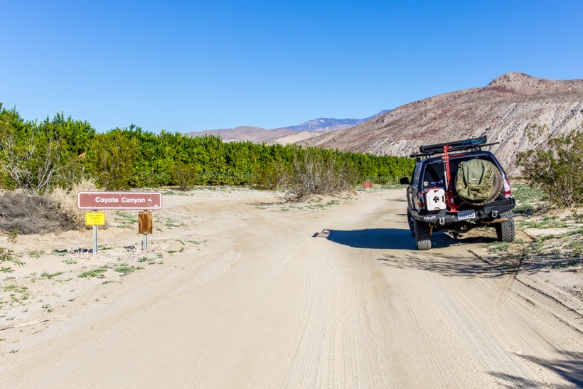
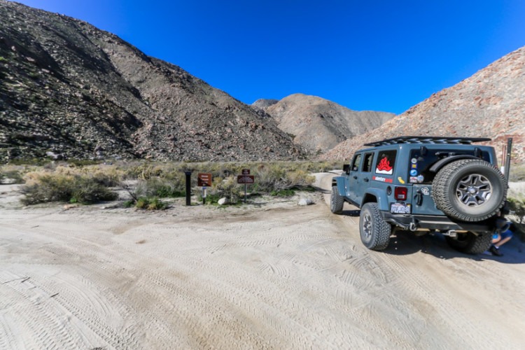
Directions: Head east from Christmas Circle in Borrego Springs on the S-22 to DiGiorgio Road; turn left, heading north. Following this paved road will lead you onto the unpaved trail to Lower Coyote Canyon.
| GPS | N33˚ 18.08 W116˚ 21.96 |
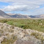
| Elevation | 700-1800 ft |
| Season | Year round: best Oct.-May |
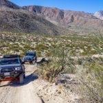
| Terrain | Rough, sandy |
| Difficulty | Moderate/rocky climb/creek crossings |
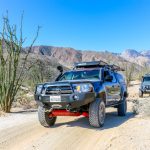
| Required Vehicle | High clearance 4×4 |
| Time | 3 to 4 hours hours |
| Length | 10 miles one way to Sheep Canyon campground |
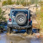
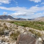
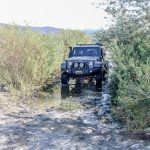
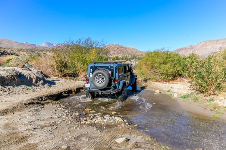
Trail Description: The trail is mostly easy but not suited for conventional vehicles due to soft sand, water crossings and patchy rough terrain including a rocky climb.There are three creek crossings, which can be potentially deep depending on rainfall and one moderately rocky climb after 5 miles.
The first creek crossing is usually dry, the others normally have year-round water with the third being up to 24 inches deep. Conventional vehicles can generally handle the trail as far as the second crossing and should stop there; not attempting to cross the creek. This trail can change from year to year due to flash flooding. For example, in past years the rocky climb has been more challenging due to storm erosion, so be aware of potential change in conditions based on seasonal rainfall. When crossing water, do so slowly to help preserve the ecosystem. Note: This trail is closed between June 1st and September 30th to preserve the watering rights of the Desert Bighorn Sheep.
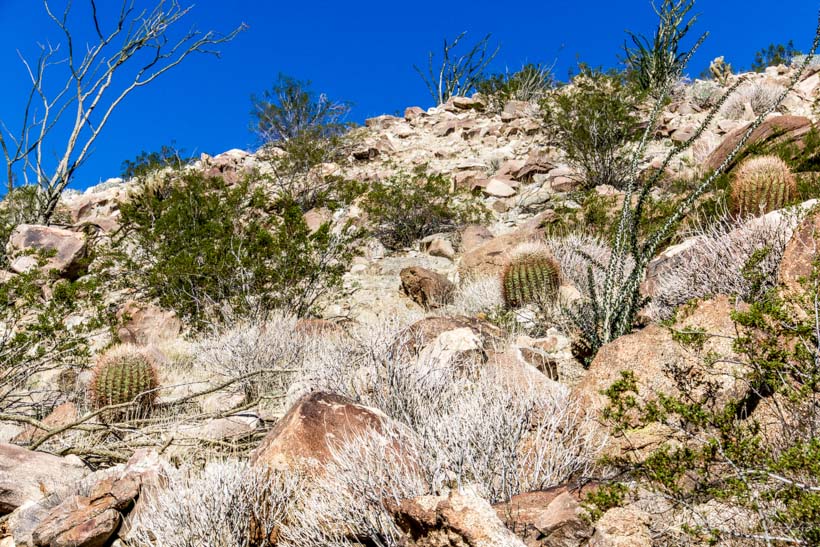
Further on there is a small picnic area with tables amongst a beautiful “garden” of succulents. This is a good stopping point for lunch, photos and possibly a hike since there are many hiking and horse trails that leave from this area.
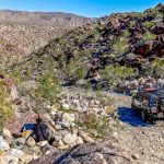
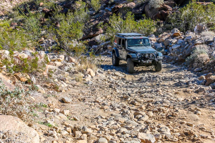
The most challenging stretch of trail comes a short distance after third creek crossing. The trail ascends a steep, rocky hill that consists of loose, fist-size rocks and moderate sized embedded boulders. The first 200 yards are the most challenging; park at the base of the climb and scout ahead on foot to be sure you want to tackle it. It is difficult to pass on this section, so if you see oncoming vehicles, wait for them to finish their descent before you head up.
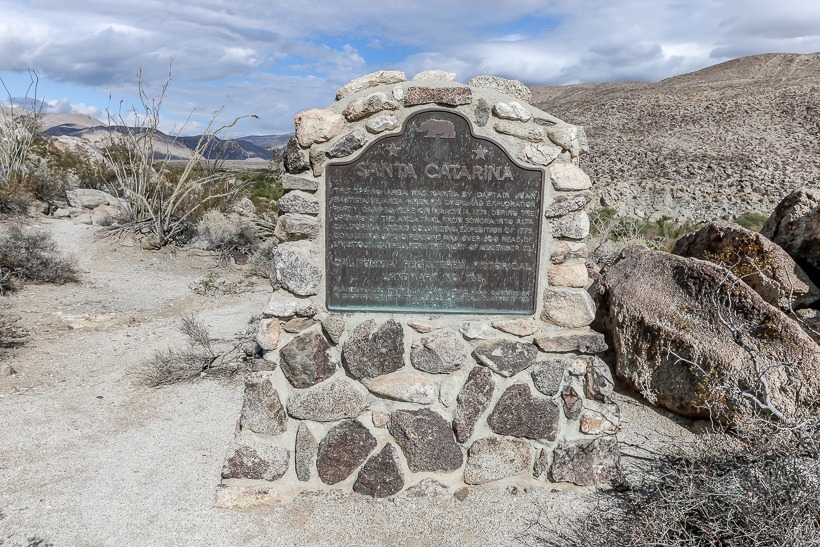
Once at the top, the trail reverts to a smooth, sandy surface as it descends into Collins Valley. A trail to the east leads a short distance to a historical marker at the site of Juan Bautista de Anza’s camp near Santa Catarina Springs.
The springs can be seen from the trail a short distance farther. The springs are a major source of Coyote Canyon’s year-round water supply and attract many species of birds and other animals. The springs are the largest natural water supply in San Diego County.

The trail forks a short distance further. The left leads you on a loop around Sheep Canyon, which passes a primitive camping area with a few picnic tables and pit toilets but no other facilities. The Indian Canyon-Cougar Canyon trail for hikers and horses leads off from near the campground. This trail passes an Indian sweat lodge as well as grinding stones.
The History of Lower Coyote Canyon: Juan Bautista de Anza first passed through the Borrego Valley using this route in 1774, on his first route-finding mission to the new Spanish settlements in California. Set in the heart of Coyote Canyon, Collins Valley was named just after the turn of the twentieth century for a squatter named Collins. He took the opportunity to jump claim on an earlier homesteader’s property.