


| GPS | N36 34.78′ W117 28.65′ |
| Elevation | 2,000-3,900 ft |
| Season | Year round: best Oct.-May |
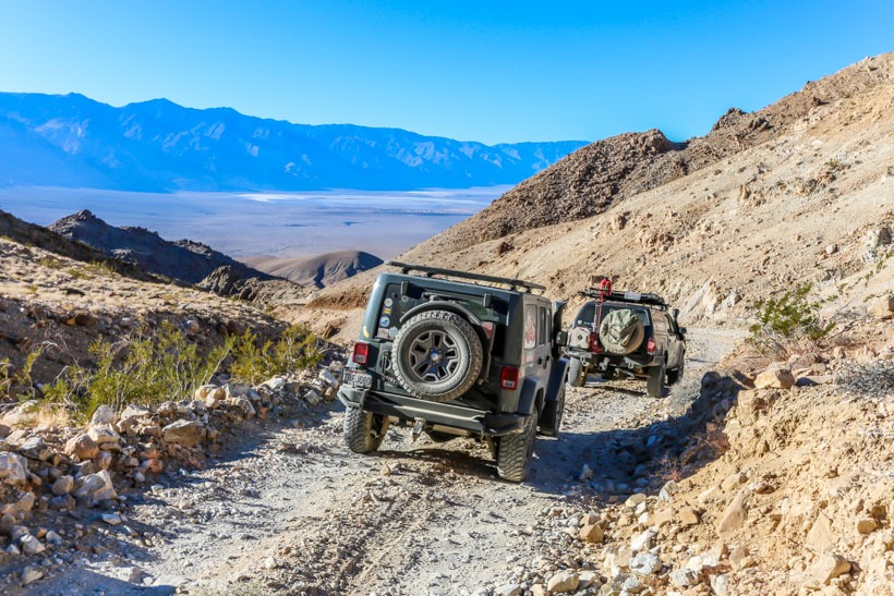
| Terrain | Loose gravel, large embedded boulders/narrow shelf road |
| Difficulty | Rugged, moderately to highly challenging depending upon recent weather conditions. Requires careful wheel placement. Trail is not maintained, beware of washouts. |
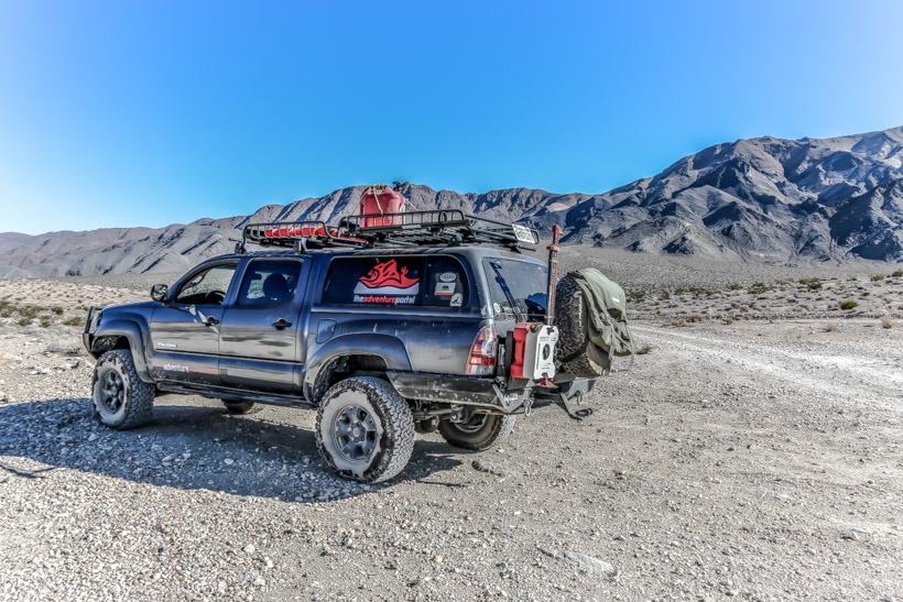
| Required Vehicle | High Clearance 4WD |
| Time | 1/2 hour each way |
| Length | 8 miles |
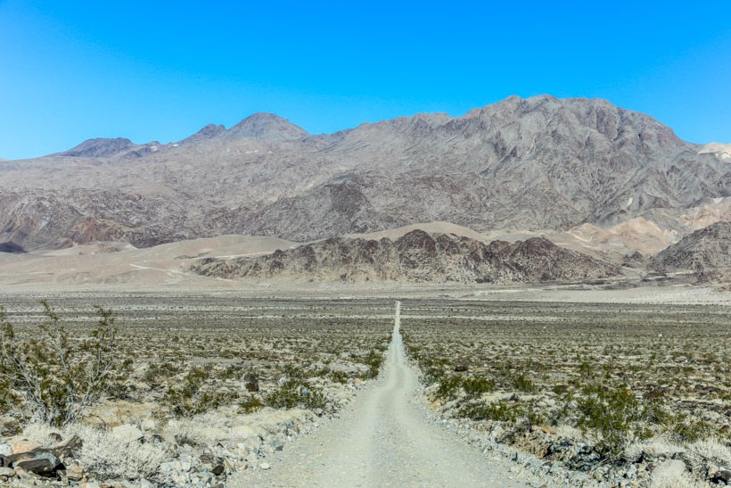
Directions to Lippincott Mine Road: Head east out of Saline Valley Road ten miles north of the end of Hidden valley road. The off-road Trail ends at a fork. The graded road on the left is Racetrack road. Keep going east and you enter Lippincott Mine Area.
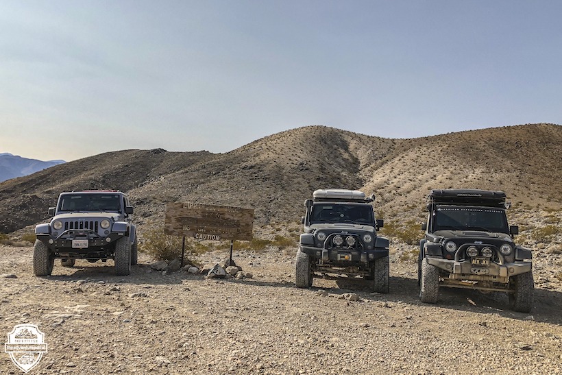
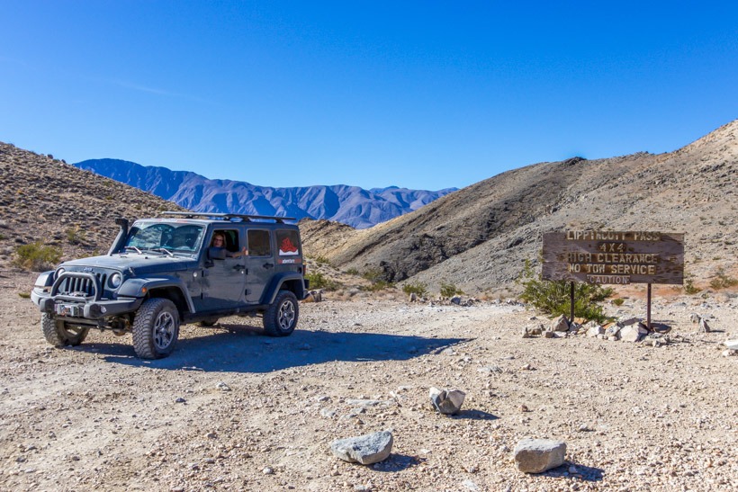
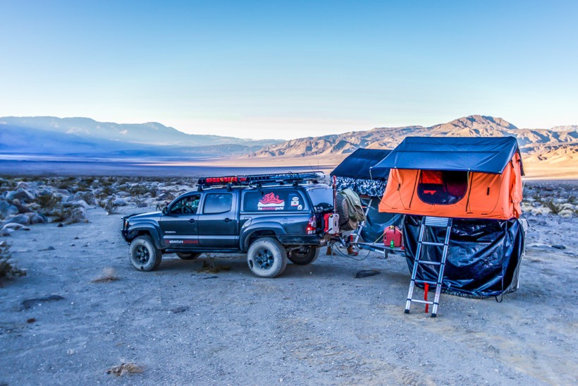
Site Location and Description: There is no trail marker or signpost for this road, coming from Saline Valley. From Racetrack Playa, there is a sign. This road is not on the map handed out by the rangers when you enter the park. Lippincott Mine Road, also called Ubehebe Road connects Saline Valley Road and Racetrack road. You can get to Saline Valley Road off of State Highway 190, west of Panamint Springs. For the moderately experienced off-road driver, this is a fun road that winds up approximately 2,000 ft and provides the Death Valley adventurer amazing views over the expanse of Saline Valley. Many guide books and on-line magazines describe this climb or descent as treacherous. We travelled it in 2014 and found it mildly challenging and fun. Wheel placement is a priority and we suggest that you do not attempt this road in a standard 2 or 4WD. Due to rocks and imbedded boulders, you will need high clearance. Again, it’s a fun road to drive BUT use caution as this is not a maintained road and even slight rainfall can seriously compromise the safety of this pass. Also know that there are some narrow ledges, which may prove difficult if there is a vehicle coming in the other direction (there are periodic turnouts). When you get to the top of the trail, you can see Lippincott mine on the far side of the canyon. The top of Lippincott Mine Road meets with the end of Racetrack Road and then there is a split off Racetrack that leads to two different parts of the mine and a primitive overland camping area.
History of: The Lippincott Mine Road in Death Valley was one of many working mines in the Ubehebe region. The earliest record of active mining on the lands that now constitute the Lippincott Lead mine was in 1906. According to George Lippincott, Jr., the Lippincott Mine produced and shipped ore during World War I. During the second world war, the Ubehebe area was used for gunnery exercises, closing the mine. By 1946 Lippincott’s Southern Lead Company resumed operations and was producing 2 carloads of lead a week. The mine was stil producing in 1951 and consisted of twelve unpatented claims. With a main tunnel 100 feet west of the mine on a hilside and running a distance of 625 feet long. The mine produced lead, silver and zinc. It closed in 1951.


