Moderate: washes, conditions change due to weather and trail can be
difficult to find/follow when obscured by sand.
Difficulty
Easy to moderate: packed dirt, washboard, sand, small rocks
Required Vehicle
Stock 4×4
Time
Approximately 1 hour
Length
4 miles each way
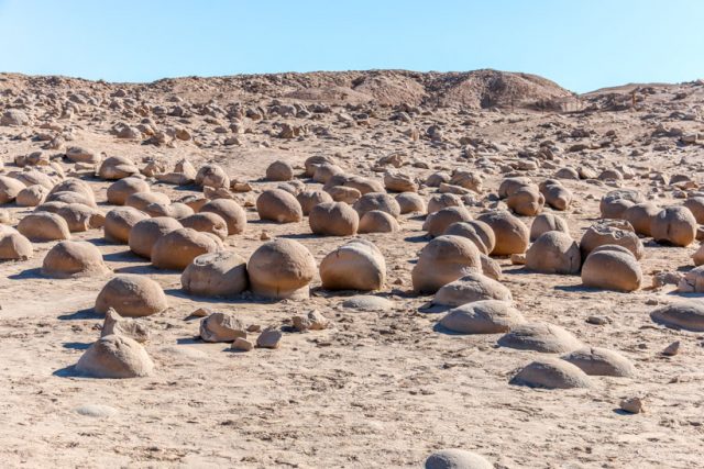
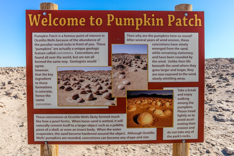
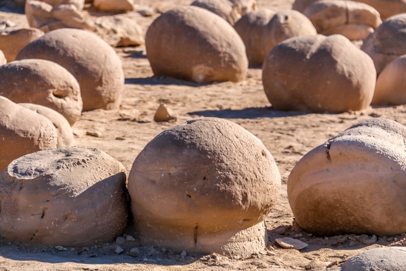
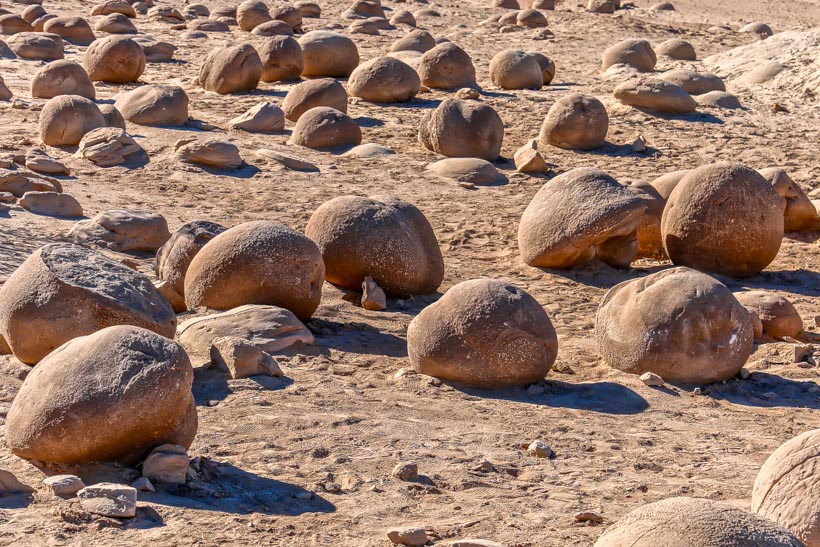
“pumpkins”
Site Location and Description To reach the Pumpkin Patch area from the south use Shell Reef Expressway to East Bank to the Pumpkin Patch Trail. It can also be reached from the north by taking the off-road Cross Over Trail from S-22 to Tule Wash. The Pumpkin patch is about as large as a city block. It is a protected area that is fenced in with an entry area allowing you to walk amongst the amazingly weird rock formations. There is a toilet and lunch area with picnic tables as well.
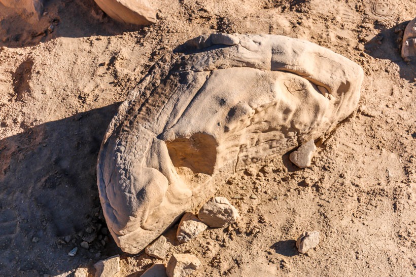
The History The Pumpkin Patch is located in the Ocotillo Wells SRVA, just east of the Anza Borrego State Park boundary. These pumpkin shaped rocks are called “concretions” and were formed under the sand by water carrying properties that solidified the surrounding sandstone forming a concrete like substance that dried and then as the sand above it blew away, came to the surface. They usually contain a natural “nucleus” in that the concretion formed around a leaf, piece of shell or possibly a fossil. Sand and weather help shape them. The sandstone is old Diablo sandstone from the Colorado river delta.
Pumpkin Patch rock formations-Anza borrego
Click here for more CA off-road, Overlanding trails…..and TAP into Adventure!
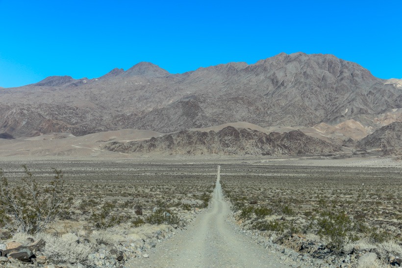
Directions: Racetrack road starts at Big Pine Road, 2.7 miles west of Grapevine on North Highway. From the Highway, head northwest following the sign to Ubehebe Crater. This off-road trail ends at Lippincott Mine Road, approximately 1 mile west of Lippincott Mine in Death Valley National Park.
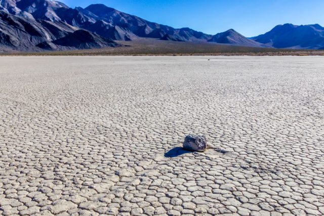
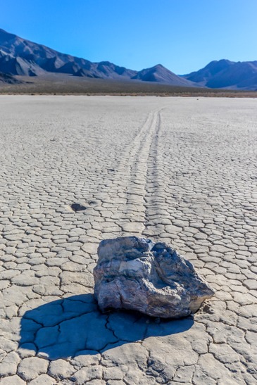
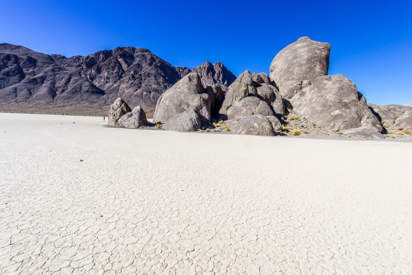
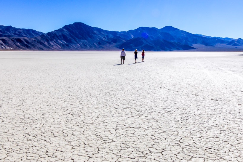
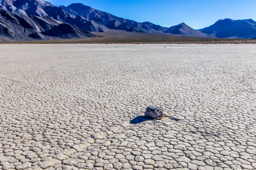
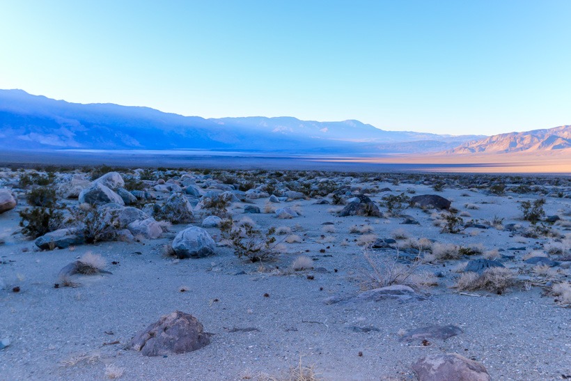
Site Location and Description: This overland style road lies in a long valley between the Panamint Range to the east and the Last Chance Range to the west. The Racetrack is located south of both the Ubehebe Crater and Ubehebe lead mines. Twenty-six miles down the road, you come to the north end of Racetrack Playa. You can park here at the Grandstand parking area. Racetrack playa is a smooth, dry lakebed with a large, dark volcanic rock formation called The Grandstand projecting far out of the lakebed. If you drive two miles south of the parking area, you will come to the mysterious moving rocks and their tracks. You will need to walk approximately a half mile out onto the lakebed to get to the rocks. You will see that the rocks have travelled quite a long distance by looking at the tracks left behind them.
Please Note: The surface of the playa is very fragile. Do not drive on it or anywhere off established roads. Please do not move or remove any of the rocks. When the playa is wet, avoid walking in muddy areas and leaving footprints. This prevents others from enjoying this natural phenomenon.
Dry lake bed-The Playa Death Valley
The History of The Racetrack: Over the years, erosion has caused rocks from the surrounding mountains to break off and fall to the surface of the Racetrack. Once on the floor of the playa, the rocks mysteriously move across the surface of the dry lakebed leaving surprisingly long trails. This phenomenon leaves many people wondering how they could possibly move by themselves. Current research suggests that a combination of rain and wind enable the rocks to move. A rain of about 1/2 inch, will wet the surface of the playa, providing a firm but extremely slippery surface. Strong winds of 50 mph or more, may skid the large boulders along the slippery mud surface. Read the article on Slate: The Sliding Stones of Death Valley, to see how ice also factors into this movement as well… or don’t and let your imagination run wild!
For more overland and off-road trails in California, CHECK HERE
Year round: best Oct.-May. Due to high elevation trail may be closed due to snow. Chains may be required. For current road information call: 760-786-2331
Terrain
Mostly Hard packed dirt coming from the west up to Cerro Gordo ghost town. Difficult traveling east toward Saline valley; very rocky and washed out. Must look for trail markers. 4 low and diff locks may be necessary while ascending from the east
Difficulty
Easy terrain (west to east) up to ghost town. difficult (heading west toward ghost town from Saline Valley Road)
Required Vehicle
You can use a 2 wheel drive until you get to the Cerro Gordo town site. High clearance4x4 is needed for the road east which is washed out and very rocky.
Time
2.5-3 hours
Length
23.7
Entering Cerro Gordo town from East
Directions: From the west: take CA 136 at Keeler, 12 miles east of Lone Pine
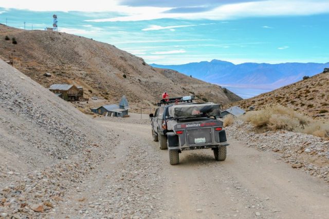
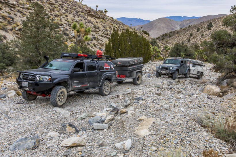
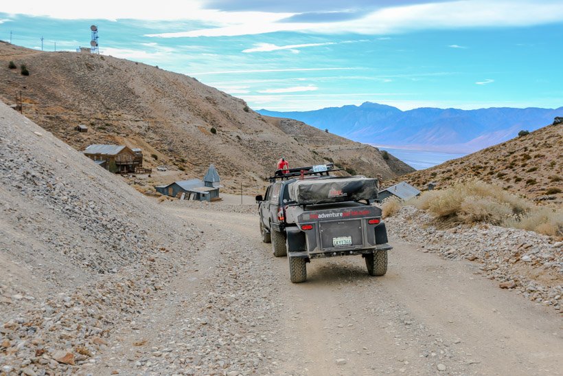
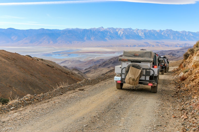
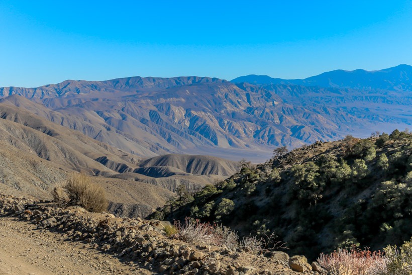
Site Location and Description: Cerro Gordo Road provides an alternate off-road entry point into Death Valley and Saline Valley Road. This 23.7 mile road travels up a steep canyon in the Inyo Mountains to Cerro Gordo mine/ghost town and then down the east side to Saline Valley Road in Lee Flat. Cerro Gordo mine is privately owned so please stay on the road while passing through the town.
When descending the east side of the range, do so only with a high clearance 4×4 off-road vehicle. Current printed guidebooks describe this trail as only slightly rough however, recent desert storms have changed the condition of the trail (2014/2015). Although this is a less steep grade than the west side, the terrain is significantly rougher; rocky and washed out. You must follow the ribbon markers as areas of the trail have been washed out completely. The vegetation is different on each side; the west side has bare, sparsely vegetated hills scattered with a few Joshua trees. The east side has pinyon and juniper trees at the higher elevations. After completing your decent of the Inyo Mountains, the trail continues east/west through San Lucas canyon, which is also prone to washouts. San Lucas Canyon leads to Lee Flat where some of the densest groves of Joshua trees in Death Valley can be found.
Cerro Gordo Road Descending west side
The History of Cerro Gordo Road:See Cerro Gordo Mine history . The west end of the road was used to transport ore out using mule teams. Later, silver was ferried out over Owen’s Lake (which was not yet dry) to the east.
Cerro Gordo Road-Mine workings on west side
Lee Flat east side of Cerro Gordo Road
Click here for more CA off-road, Overlanding trails…..and TAP into Adventure!
The American Hotel in Death Valley Cerro Gordo Ghost town
GPS
N36 32.2626′ W117 47.70186′
Elevation
8,500 feet
Season
Year round. Check for snow
Terrain
Packed dirt steep climb
Difficulty
Easy terrain
Required Vehicle
High clearance 2WD from the west off Hwy 136 and high clearance 4WD from the east off Lee Flat Road. Steep and inaccessible from the east in winter without chains. Road conditions dependent on latest storm conditions. call: 760-786-3200.
Time
1/2 hour
Length
4 miles each way
Death Valley-Cerro Gordo Ghost Town
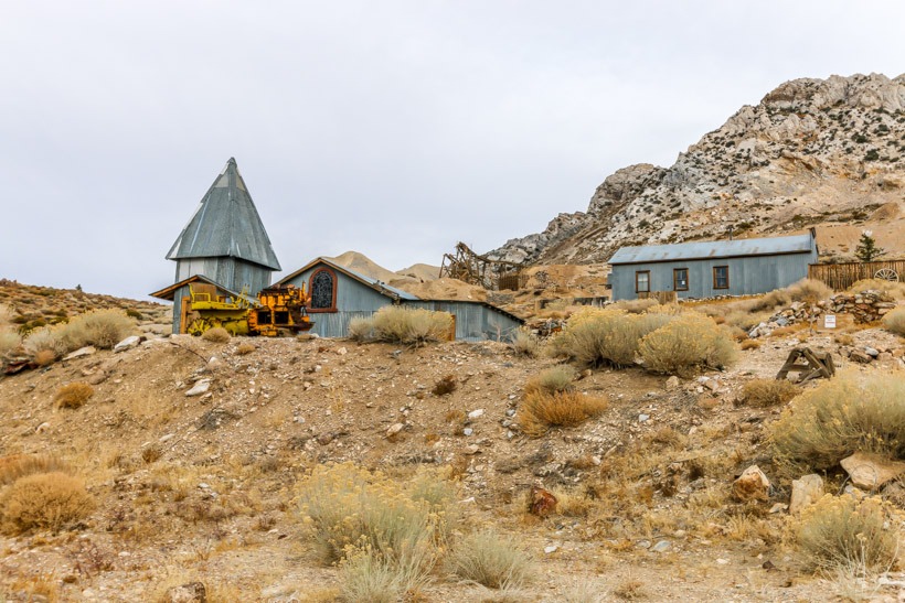
Site Location and DescriptionCerro Gordo Ghost Town located in Death Valley, is considered one of the best ghost towns in California. It is privately owned and operated by the Cerro Gordo Historical Society. Because this is on private land, permission to visit must be obtained. Do not try to enter buildings without the caretaker there to give you a tour and do not remove any items from this historic site. TAP note: Robert, the caretaker, may be available for a guided tour. He is friendly and highly knowledgeable. If he gives you a tour, please feel free to leave a generous tip as it goes to the maintenance of this amazing piece of historical Death Valley. This 1868 town site includes: the American Hotel built in 1871, the 1904 Bunkhouse, and the Belshaw House built in 1868. The General Store, now a museum, gives the visitor a peek at the colorful history of the mine and life in the town as well as a vast array of artifacts to explore. You can also see the 1877 Hoist Works, and numerous other remaining structures. The views from this town site are amazing.
Directions: Starting point from the west: California 136 at Keeler, 12 miles east of Lone Pine.
Death Valley Cerro Gordo Ghost Town saloon
The History of Cerro Gordo Mine
The Early Days…
Cerro Gordo, means “fat hill”in Spanish. It was named for the vast amount of silver it contained. The principal mines at this time were: San Lucas, San Ygnacio, San Francisco, and San Felipe. Within four years, the number of mining claims would increase to more than seven hundred.
Cerro Gordo’s ore was of extremely high quality, but numerous obstacles restricted it’s growth, these being mainly the ruggedness of terrain, scarcity of water on the mountaintop, and the location which was far from any settlement with a large population. It did not become a boomtown overnight. The first claim to be seriously developed was the San Lucas mine in 1866 by Jose Ochoa, who was extracting about 1112 tons of ore every 12 hours. The silver ore was transported in sacks by pack animals to the Silver Sprout Mill located west of Fort Independence.
The “Boom”….
This trade brought prosperity to Los Angeles and, by the end of 1869, 340 tons of bullion had passed through the city. Cerro Gordo and it’s silver ingots(retangular blocks of silver) became well known and were displayed in most prominent businesses. News of the lawless”goings on” at Cerro Gordo was widespread and many prospectors heard that copious amounts of riches were to be had there. Local farmers and businessmen prospered from sending mule wagons and other freighters full of produce, flour, sugar, barrels of wine and all other consumables as well as bales of hay and mining tools to the Cerro Gordo miners. Within a year, Cerro Gordo was the leading source of business in Los Angeles.
By 1871, Cerro Gordo was well established as a mining town. The American Hotel was completed that year, as were several other permanent structures. A general store, restaurants, and saloons replaced the canvas shacks that has been scattered throughout town. Small clusters of stone and canvas homes were built down the San Lucas canyon and the side of the canyon was also covered by prospect holes. The biggest structure located there was the the 300-foot vertical shaft house covering the Newtown mine.
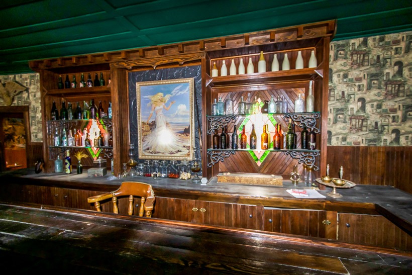
Cerro Gordo was known as a “wide-open town”, meaning it had only little to no law and order. The law was not respected by most of the town’s inhabitants, and enforcement proved a challenge. This lawless type of miner/prospector found Cerro Gordo’s remoteness a refuge, and was responsible for the bloody record of shootings compiled during the bonanza days. Today, you can see the bullet holes of past fights in the saloon area.
Whiskey and women made the dance halls, and the red-light houses the main stage for gun battle. A story told by Dr. Hugh McClelland, a physician at Cerro Gordo claims that he had gone to a dance hall with friend and was telling him about a nick-name given to one of the girls there. She came at him with a stiletto in her hand and was intercepted by another girl who caught her by the wrist and grabbed the shoe out of her hand. Meanwhile the first girl’s enraged boyfriend was shot while attempting to charge the good doctor with a knife drawn, ready to plung it into him. As a result of the killing, a widespread gunfight broke out amongst the attendees and stopped only when the lights were extinguished.
Click here for more CA off-road, Overlanding trails…..and TAP into Adventure!
Year round: best Oct.-May although higher elevations may be closed due to snow. Call:760-786-3200 for weather info
Terrain
Packed dirt, sand in places, washboard
Difficulty
washboard, packed dirt, long distance with no facilities and possible harsh weather condions
Required Vehicle
High clearance 2 or 4 wheel drive
Time
5.5 hours
Length
91.4 miles — 78.8 unpaved
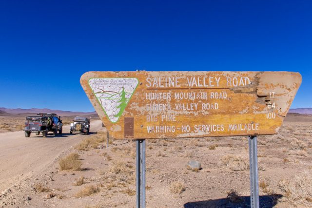
Directions: Saline Valley Road starts at California 190, 9.5 miles east of the intersection with CA 136. It ends at California 168, 2.5 miles east of Big Pine and the intersection with US 395.
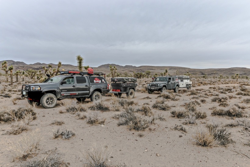
Site Location and Descripton: Saline Valley Road is one of the most remote locations overland in California. This desert basin in Death Valley National Park is surrounded by rugged mountains on all sides. It contains a wonderful Joshua tree forest (8 miles in at Lee Flat), a salt marsh, sand dunes, and a warm spring. This valley gives the overland adventurer amazing views of both the Inyo Mountains and, if you choose to set up your primate overland camp there, a fantastic array of brilliant stars in the night sky. This is truly a peaceful and beautifully unique destination on your journey through Death Valley.
Saline Valley sunset
History of Saline Valley: Saline Valley is best known for it’s salt and borax mining operations. Borax was discovered there in 1974 and was mined there from the late 1880’s through the early 1900’s. Salt was mined there at the same time as well but did not become a major concern until 1903. The need to transport the salt to the ferry and railroad on the western side of the Inyo Mountains for shipment across what was then Owens Lake led to the development of the salt tramway. It was constructed between 1911 and 1913 and ran from the floor of Saline Valley, up and over the Inyo Mountains, to Swansea in the Owen Valley.
View from Saline Valley Road
For more Californian Overland and Off-road Trails, CHECK HERE
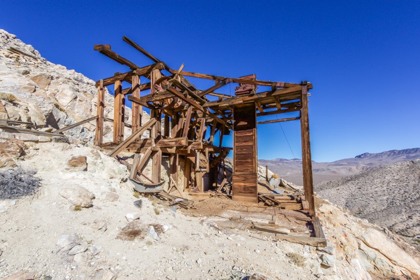
Lost Burro Mine equipment from trail going up to it
Lost Burro mine Death Valley
GPS
N 36 44.91′ W 117 31.49
Elevation
Approximately5200 ft
Season
Year round: best Oct.-May
Terrain
Packed dirt, gravely wash
Difficulty
Trail guides indicate a difficulty rating of 2. We found it rocky and washed out (2014/2015)
Required Vehicle
2 or 4 wheel drive. High clearance is best
Time
As long as you like to explore this amazing mine.
Length
1 mile off Hidden Valley road
Lost Burro Mine equipment
Directions: Turn-off to Lost Burro Mine trail is 3.1 miles from Tea Kettle Junction on Hidden Valley Road in Death Valley National Park.
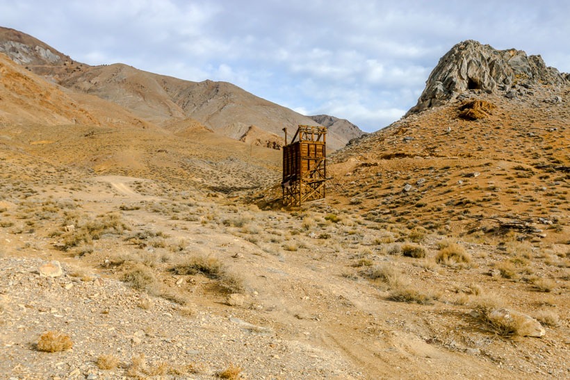
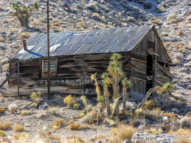
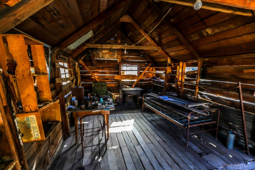
Site Location and Description The mine is located a proximately a mile up Lost Burro Gap off of Hidden valley road. Lost Burro Gap is a narrow canyon of tilted, striated rock with a trail that follows a gravelly wash through this short but beautiful gap in Death Valley. Lost Burro mine is on a side trail and is clearly visible from Lost Burro Gap. The site includes extensive mining remains set in a tight, small canyon. There is a miner’s cabin full of interesting mining tools as well as old furniture and cooking utensils, cans etc., an outhouse, and various wooden structures. There are ore bins, various mine openings, and concentrations of equipment, and machinery parts.
Inside Lost Burro mine bunk
The History of Lost Burro MineIn 1907 a prospector named Bert Shively was chasing his burro who had strayed. Bert caught up with his burro in a remote canyon and picked up a rock to throw at him to get his attention only to discover that it was laced with gold. In 1915 the Montana-Tonapah Company built a water powered 5-stamp mill, with water piped in from Burro Spring 8 miles away. The Lost Burro changed hands many times over the years, the most productive years were between 1912-1917. Mining continued sporadically until the mid-1970s.
Click here for more CA off-road, Overlanding trails…..and TAP into Adventure!