


| GPS | N33 08.20 W116 22.70 |
| Elevation | 1400-4000 ft. |
| Season | Year round: best Oct.-May |
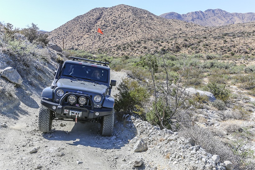
| Terrain | Packed dirt, small rocks, sandy in places, washboard, some narrow |
| Difficulty | Easy terrain |
| Required Vehicle | 4 wheel drive |
| Time | 1.5 hour |
| Length | 13.6 miles each way |
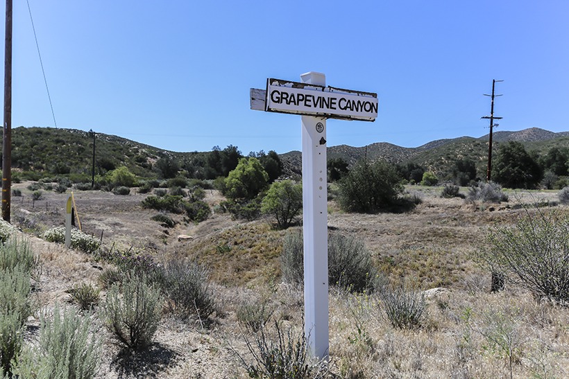
Directions: Grapevine Canyon Trail begins on Yaui Pass Road (S3), .1 miles north of CA 78 and 12 miles south of Borrego Springs.
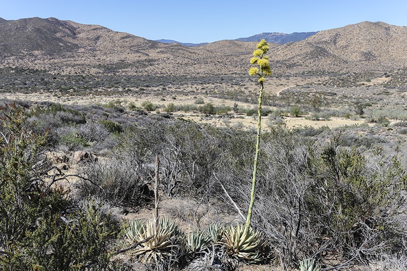
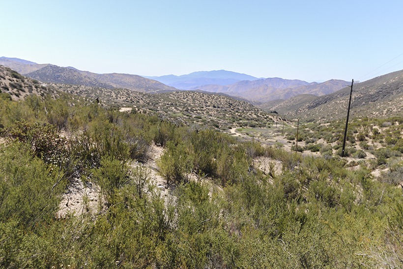
Site Location and Description: We used the Grapevine Canyon Trail as an alternate way to leave Anza Borrego State Park and head home to San Diego. Glad we did. This beautiful canyon winds through Yaqui Flat, up Grapevine Canyon and past Angelina Spring, an old Indian village site. It leaves Anza Borrego State Park and goes through Hoover Canyon to the Montezuma Valley Road (S22).
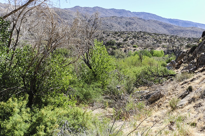
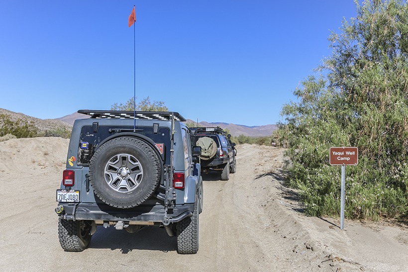
There is camping (with pit toilets) at Yaqui Well as you enter from the southeast. When the trail takes you past Stuart Spring and close to Angelina Spring, the vegetation becomes lush and green. Then you climb the bajada up a singletrack, slightly rocky portion of the trail. Once you reach the top, there are wonderful views of the canyon below and the San Felipe hills. As you leave the park you will notice a few privately-owned dwellings. These become more numerous on the last 5 miles of the trail before reaching S22.
History of Grapevine Canyon: Before Highway 78 and County Roads S-3 and S-22, the Grapevine Canyon trail was a main thoroughfare to the Borrego Valley. Horses and wagons went eastward through the Narrows and then up what is now the Old Borrego Valley Road. Even before that, the northern and southern bands of the Kumeyaay Indian tribes inhabited this area. The tribal boundaries lay close to the San Felipe Creek near Yaqui Well. Some used Yaqui Well as a winter camp for gathering and processing food. In 1929, San Diego County built it’s first prison road camp or “honor farm” close to Yaqui Well. The officials planted tamarisk trees to offer some shelter and today this is the site of the Tamarisk Grove Ranger Station and Camp located at the western end of the trail. The prisoners used hand tools to create the first roadbed along the San Felipe Creek. In 1933, it became California state highway 78.


