Andy Palmer – Owner and President of The Adventure Portal
Why did you choose your rig platform and how long have you had it?
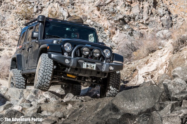
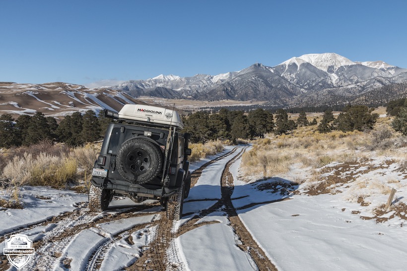
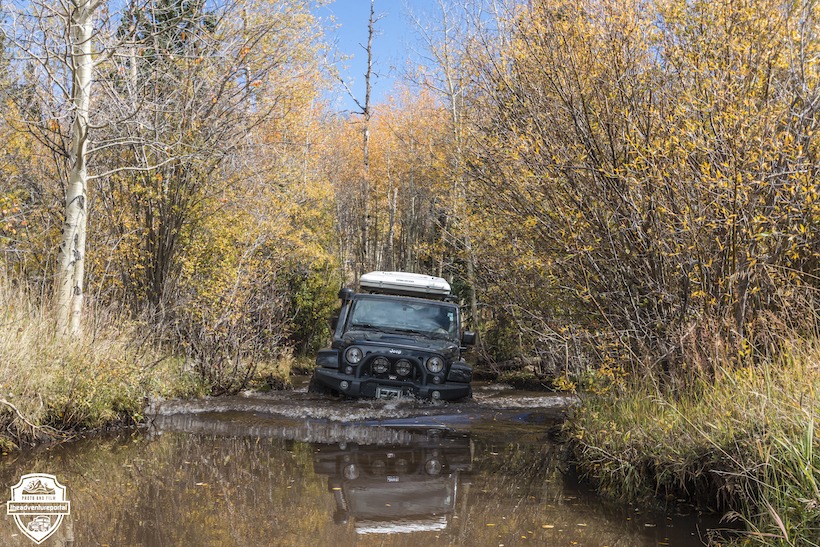
I purchased this JKU in 2018 used with 66k road miles on the clock. At the time I was driving a 2010 Tacoma and was simply getting the itch for something different. My Wife had a similar AEV JKU and there were times she would easily handle technical terrain, when I would struggle a little, so it made sense to join her in the Jeep club.
What mods have you done to it and why?
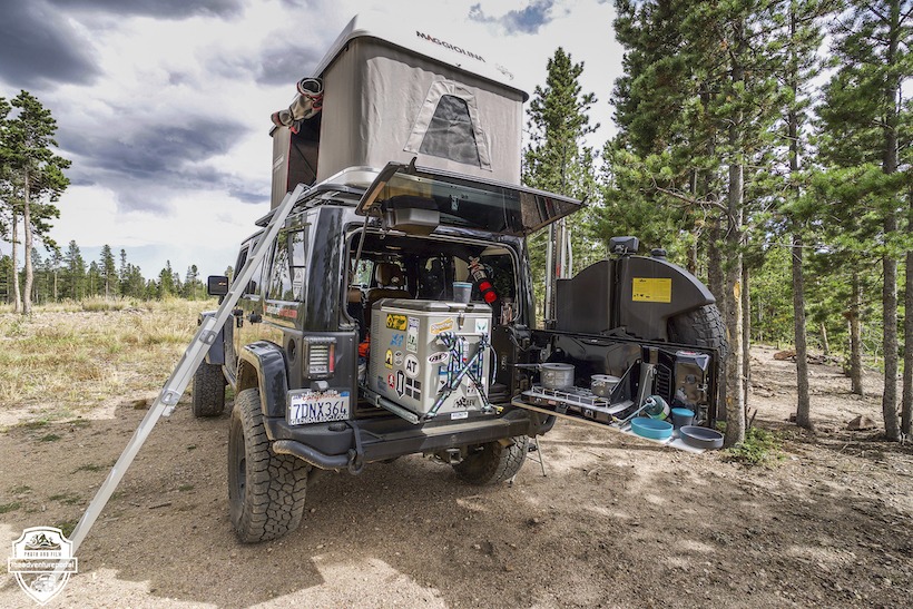
It came as a well built AEV rig, although I have still added quite a lot. My first overland focused mods were interior focused where I added a Goose Gear 60% seat delete, Tembo Tusk fridge slide and wiring to the main battery. I also added an Outback Adventure Trailgator. On the dash, I installed a Vector full width bar with two 67 designs carbon fiber arms mounts for my phone and GPS.
The exterior off-road focused mods have been significant, with higher capacity springs, Dynatrac ball joints, heavy duty Steer Smarts tie rods, draglinks, track bar and steering damper mount. The rig came with BF Goodrich AT KO2’s that I have replaced with 35” Falken Wildpeak AT3’s.
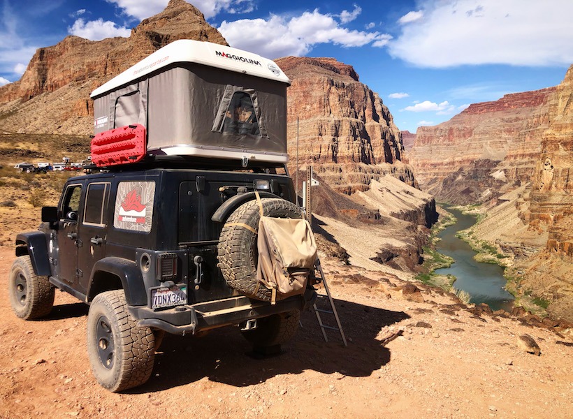
The only other significant purchase was a Autohome Maggiolina RTT.
What would you do differently if you could start from scratch?
With the Goose Gear build out I should have gone with a full rear seat delete, as I’ve never used the remaining seat. If money was no object, I’d also replace the RTT with an URSA Minor shell as I’d like to lower the center of gravity a little and this would achieve it without losing sleeping comfort. A Hemi engine would also be nice!
What’s the one thing that makes your rig awesome for you?
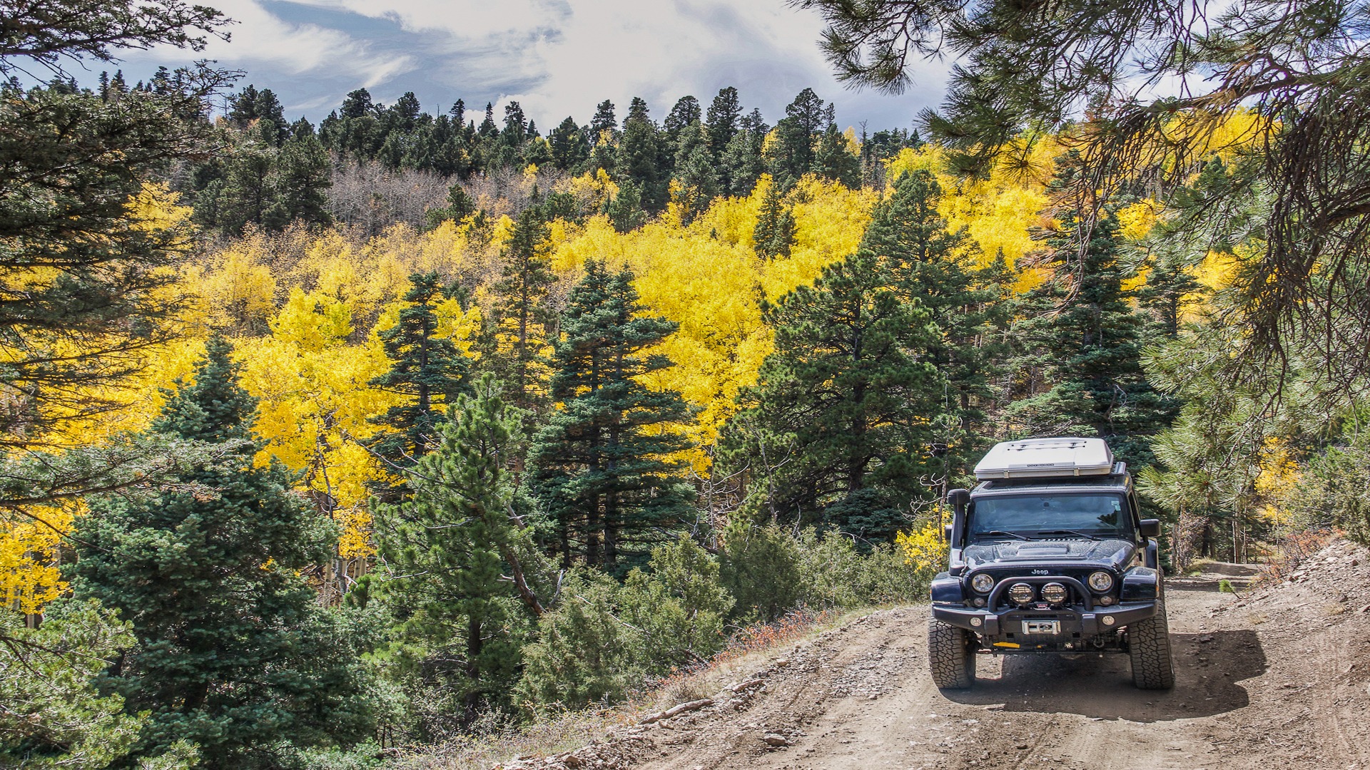
The technical ability of the JKU off-Road is exceptional and I really enjoy the confidence off road it gives me to tackle difficult trails. It’s taken me to some pretty amazing locations.
What’s not so great? What characteristics would you change if you could?
The gas mileage sucks at an average of 13.9mpg. Now it’s over $4 that’s beginning to hurt. The engine is definitely under powered for road use. When I put the pedal down, I hear a lot of engine noise but not much happens. Finally, the Jeep interior is small and fills up fast. With all my camera gear and camping needs, I’m full.
Final thoughts and words of wisdom when choosing an overlanding adventure rig?
There is no perfect rig, so stop trying to identify it. Make a list of your top 10 things you’re looking for and get the rig that fulfills the most of them. I doub’t you’ll find anything that is a 10 out of 10. Secondly, don’t add crap for the sake of it. I know it all looks awesome, but really think it through. Do you really need all that expensive and heavy body armor if you’re simply going to be on dirt roads? Be honest with yourself.
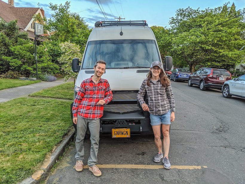
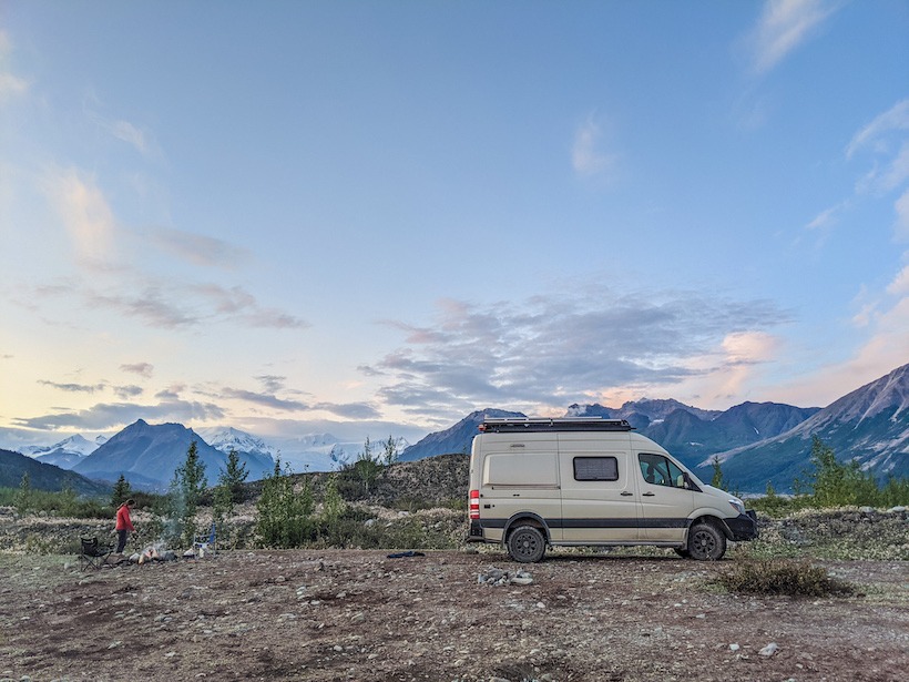
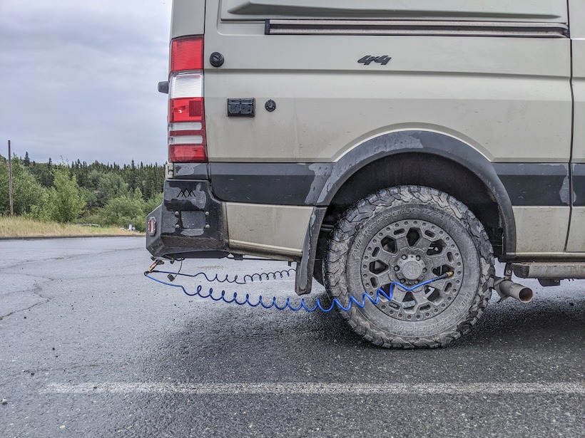
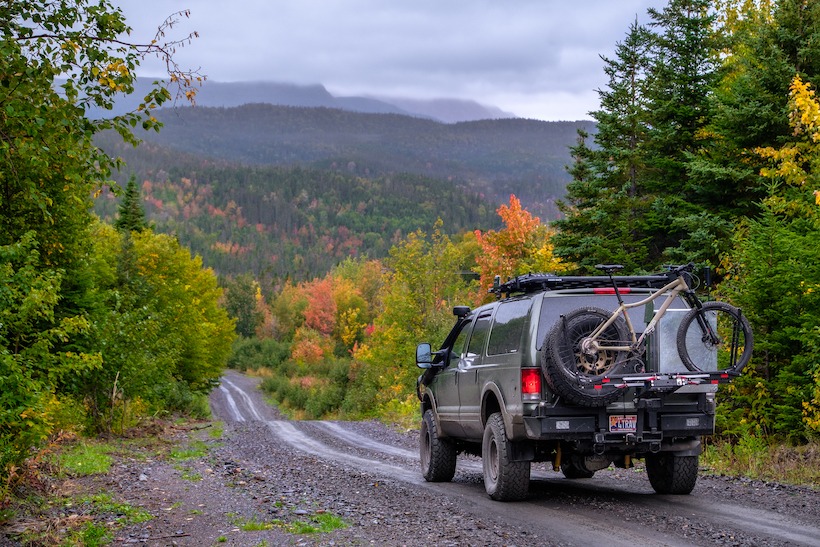
As a quick introduction, we are David and Kelly, 30-somethings from Portland, Oregon who have the good fortune of spending the summer in Alaska in our van, the Gnar Wagon. We’ve had our van, a 2019 Winnebago Revel, for about three years and spent fifteen months traveling around the United States and Canada in 2019/2020. We intended to end our original trip in Alaska, but with COVID ended up returning to Portland for a bit and delaying our Alaska travel. We love hiking, nature photography, boondocking, breweries, art, and planning trips as we go. We couldn’t ask for a better place to spend the summer or a better rig to do it in. We picked our van for its toughness (4×4, short wheel base, expedition front bumper) but we love the comforts it provides (induction stove, toilet and shower, furnace, lithium batteries, twenty-one gallons of fresh water storage). We never miss an opportunity to leave the pavement and get away from civilization, which we recently accomplished with a trip to Kennicott and McCarthy.
Gnar Wagon: David and Kelly
Kennicott is located on the southern side of Wrangell-St. Elias National Park and Preserve. It’s the largest national park in the United States, covering 13.2 million acres! Most of Wrangell-St. Elias isn’t accessible by road and there are few established trails in the park. Kennecott was developed in the early 1900s after prospectors discovered rich copper veins in the mountains and was quickly built up as a company town. A second town, McCarthy, was built just five miles away to support the vices of the miners, as drinking wasn’t allowed in the company town. Kennicott and McCarthy are located about ninety miles east of one of Alaska’s primary highways (Richardson Highway), and reaching them by vehicle requires driving over forty miles of unpaved roadway. When researching how to spend our summer in Alaska, we were immediately attracted to Kennicott and McCarthy by the history and hiking, in addition to the exciting route to get there!
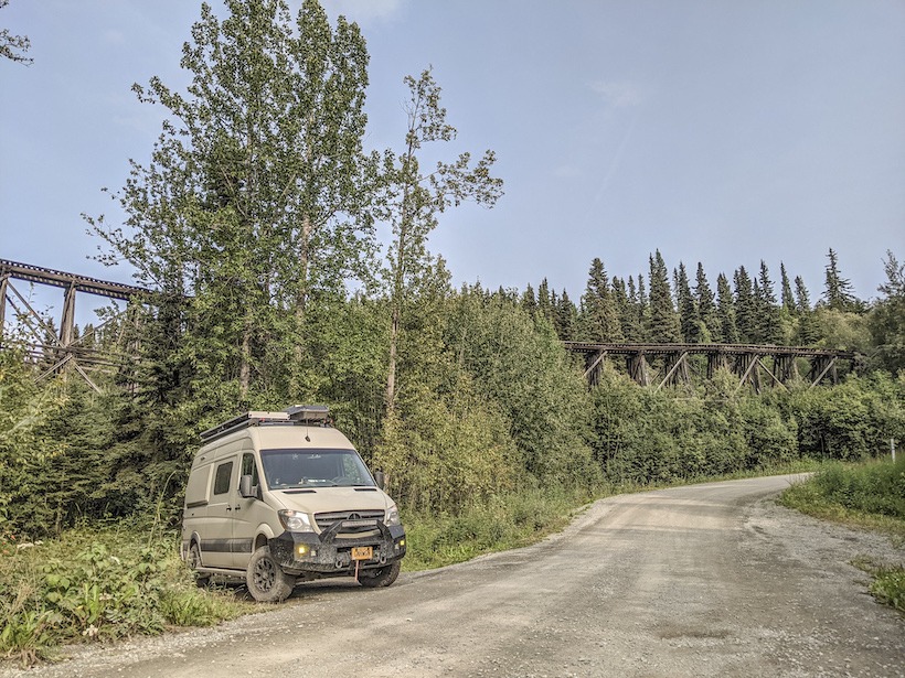
While some of the businesses in Kennicott and McCarthy have running water and electricity, there aren’t any dump stations or hose hook-ups for RVs. Therefore, we were sure to start our journey with a full water tank, empty gray tank, empty cassette toilet, stocked fridge, and full tank of diesel. The sixty-mile largely unpaved road to McCarthy starts in Chitina, a small railroad town that sprung up when the railroad to Kennicott was completed in the early 1910s. The road largely follows the old railroad route, which was abandoned in 1938 when the mine closed down. Just after leaving Chitina you pass through the narrow “railroad cut,” which was originally a tunnel for the railroad. Other signs of the railroad are evident along the way, including the Gilahina Trestle, which was built in eight days in the winter of 2011. Although most of the railroad track was removed for scrap metal, we still saw pieces of track occasionally and were warned to watch for railroad spikes on the road.
Gilahina Tresle
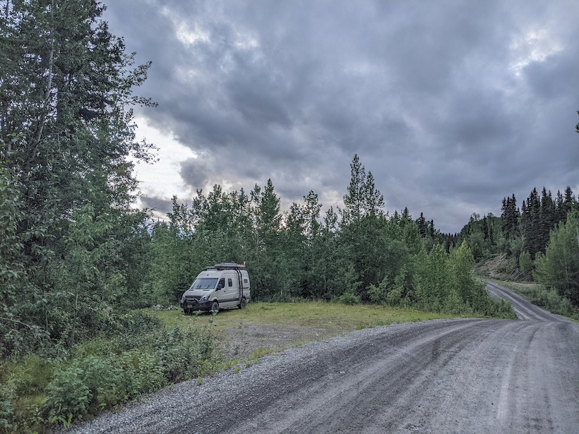
We aired down to about half of our typical tire pressure after the pavement ended just east of Chitina. We’ll usually reduce our tire pressure if we expect to be on dirt and gravel for more than a few miles, as this helps soften the ride and makes washboard a little more tolerable. We were pleasantly surprised by the road condition and for the most part maintained a speed of about twenty miles per hour. We stopped every so often for pictures and once to do a short hike before deciding to camp for the night. We found a large pull off and checked our mapping app to make sure we were on public land, as there is lots of private land along McCarthy Road.
McCarthy Road Camp Spot
The next morning we completed our drive to McCarthy, or at least as close as we could get. Visitors aren’t actually allowed to drive into the town but must park at the end of a footbridge about a mile away. There are two campgrounds at the end of the road, which are really just dispersed camping on private land. The campground we stayed at cost $25/night and didn’t have any formal sites or amenities, beyond a single pit toilet. There isn’t any free camping within a few miles of McCarthy, so we opted for the convenience of the campground. After spending too long trying to find the best site, we left our van for the day and walked to McCarthy to look around. There are only a couple dozen people who live in McCarthy year round, although the population swells a bit in the summer to support the tourists. There are a couple of restaurants, a small museum, a few pit toilets, and a some guide companies in McCarthy. There are also a lot of very friendly dogs roaming around, raspberry bushes, and a small number of tourists. Most of the activities we planned to do are in Kennicott, which is about five miles up a dusty, bumpy road. One of the biggest challenges during our trip was getting between McCarthy and Kennicott. After walking the road our first time up to Kennicott, we opted to rely on local shuttles for future trips. There are two rival shuttle companies in town. We quickly warmed to the short white bus driven by Dan, a long-time local. Dan is a chatty character, full of stories and well known among McCarthy’s residents. We learned about the property he inherited in town from a longtime friend as well as the work he is doing for kids in the area. After just a few rides with Dan, we felt like regulars on the bus.
McCarthy Campground
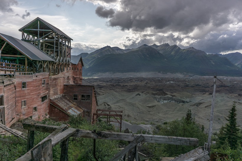
We spent our first afternoon touring the mining operation in Kennicott. The town of Kennicott is named for the Kennicott Glacier, but the mining company is the Kennecott Copper Corporation (supposedly the spelling difference is due to a clerical error). When the mine shut down in 1938 much of the equipment and buildings were abandoned, leaving a ghost town for decades until some people saw an opportunity to reinvigorate the area as a tourist destination. The National Park Service has rehabilitated many of the original buildings, some of which you can only enter with a tour guide. We spent the majority of our tour in the fourteen-story concentration mill, where ore arrived by tramway to be crushed, sorted, bagged, and placed in rail cars for transportation to the coast. The building has been refurbished just enough to be safe for entry, but feels abandoned with random artifacts scattered around, including old tools and equipment. The setting for the mill and town is incredible, with views of glaciers and some of the highest mountains in the United States, including Mt. Blackburn.
Kennecott Mill with Mt. Blackburn, the fifth-highest peak in the US at 16,390 feet
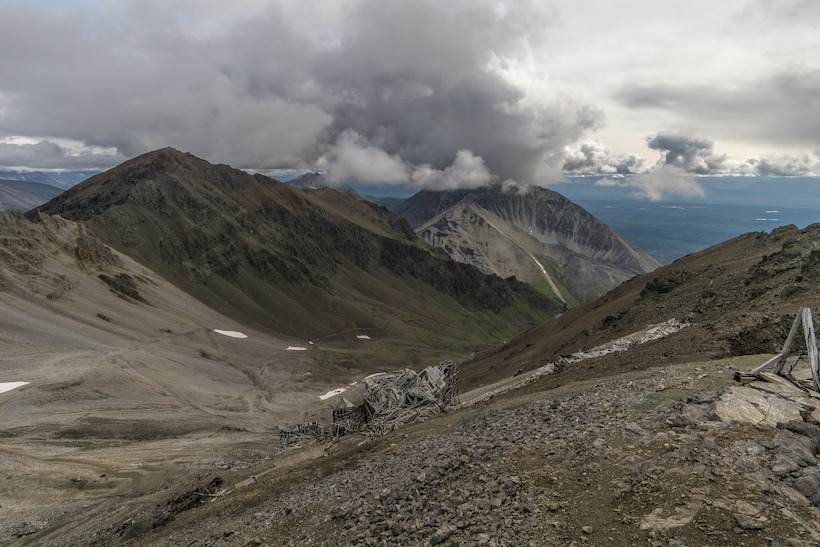
Several hikes leave from Kennicott, most leading to original mining areas and the Root Glacier. We hiked to Bonanza Mine our second day and ended our visit to Kennecott hiking on Root Glacier. Weather in Alaska in the summer is unpredictable and often grey, but we lucked out with partial sunshine and enough visibility to see some of the surrounding mountains. Bonanza Mine is about four miles from Kennicott and the trail gains almost 4,000 feet in elevation. Miners would live in a bunkhouse at the mine and only occasionally make the trip to Kennicott, sometimes by riding on the tram cars that moved ore from the mine to the concentration mill! There are old tools and appliances scattered around the mine and hillside, which we learned the National Park Service considers “historic refuse.” We loved exploring around the mine and guessing at how the various equipment worked.
Bonanza Mine
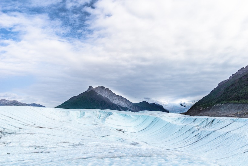
Root Glacier is only a couple miles from Kennicott and the most accessible way to walk on some of the over 5,000 square miles of glacial ice in Wrangell-St. Elias. Much of the glacier is covered by dirt and rocks, but the Root Glacier trail leads you to an area that is largely ice. We only had one pair of yak traks between the two of us and the glacier is quite slippery, so we didn’t venture too far. While we’ve skied on the Palmer Glacier on Mt. Hood at home, this was our first time walking on a glacier in Alaska. While a local told us, “Once you’ve seen one glacier you’ve seen them all,” our fascination with glaciers likely won’t end anytime soon.
Root Glacier
After hiking on Root Glacier, we returned to our van and left the campground in the early afternoon, deciding to camp one night on McCarthy Road on our way back. At this point, it had been five nights since our last dump station/water fill-up and our fresh water was running very low, along with our supply of produce and refrigerated food. We’ve found about five days is the maximum time we can go between water fill-ups, which is our limiting factor when off the grid. By this time we are usually craving some fresh food, a restaurant meal, or a real shower. We spent our last night in an informal campsite that we scouted using aerial imagery from Google Maps. We usually rely on iOverlander, a great app for finding camp spots on public land, but it didn’t have much to offer in this area. The next day we finished the drive to Chitina, aired the tires back up, and returned to pavement for the rest of our drive back to Anchorage to prepare for our next adventure.
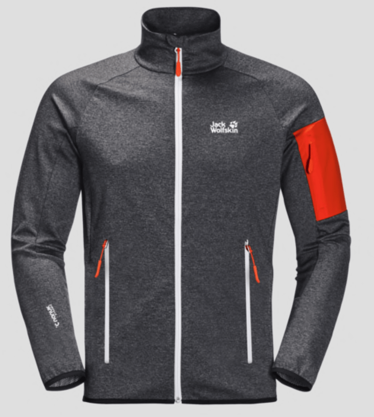
Designed for comfort and advanced freedom of movement on day hikes and trekking trips, the MILFORD JACKET is made of a stretchy fleece fabric with a smooth exterior and a soft reverse side. The fabric looks great and has superb, kind-to-skin feel.
The jacket is extra light and super breathable – ideal attributes for active outdoor use. Items you might want to keep handy, like your folder or phone, can be stowed in the two hand pockets or the sleeve pocket.
TAP Thoughts: I’ve used this well designed/made fleece jacket while hiking throughout the last few months and its breathable fabric has definitely performed great on the trail. It’s also water resistant and the stretchy fabric is lightweight and comfortable. It has an athletic fit and aesthetically has a European flavor, with its bright ascent colors. I’m 190lbs/5’10” and wear an XL.
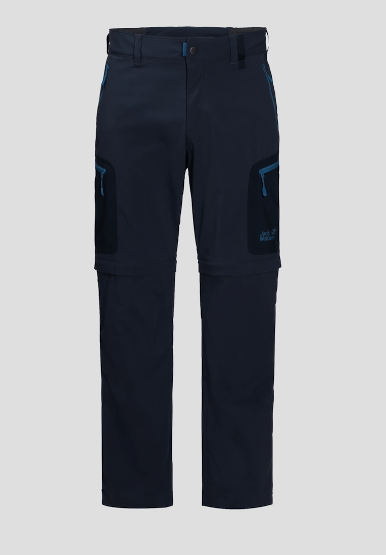
Steep mountain paths can be tough going, but the views are definitely worth it. And the ACTIVATE LIGHT ZIP OFF trousers make every step a pleasure. These versatile softshell trousers – part of our ACTIVATE series – are super light, very breathable and extremely flexible.
The FLEX SHIELD X-LITE fabric has multidirectional stretch properties and is purpose-made for demanding trails and agile, dynamic movement. It keeps you dry in light showers and on hard, sweaty ascents and protects you from the sun.
The ACTIVATE LIGHT ZIP OFF convert to shorts in an instant – simply zip the legs off and enjoy the extra freedom! With a total of five pockets, there’s plenty of room for your smartphone, GPS and other little essentials.
TAP Thoughts: We were also sent these light weight soft shell hiking pants from Jackwolfskin. Again, they are designed for high activity and are made of a soft stretchy material. Although light rain resistant, I’ve really only used them in hot dry conditions, where I found them breathable and cool. I also particularly like the versatility of having zippered legs that makes them into shorts.
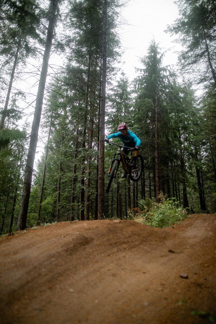
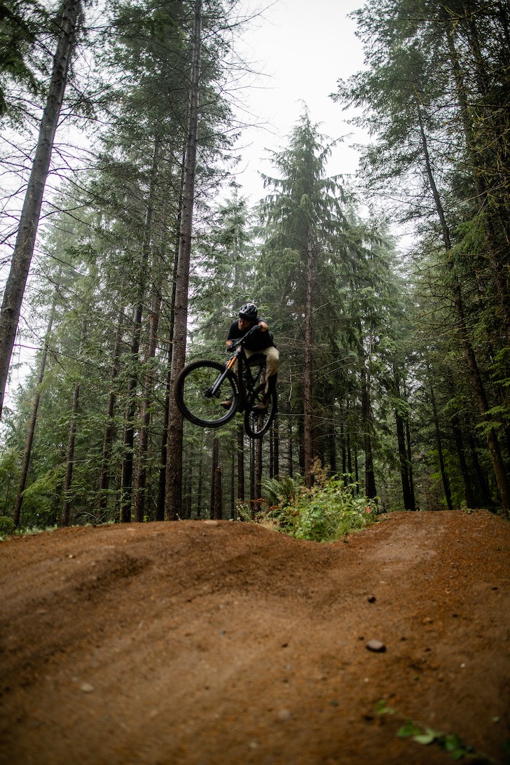
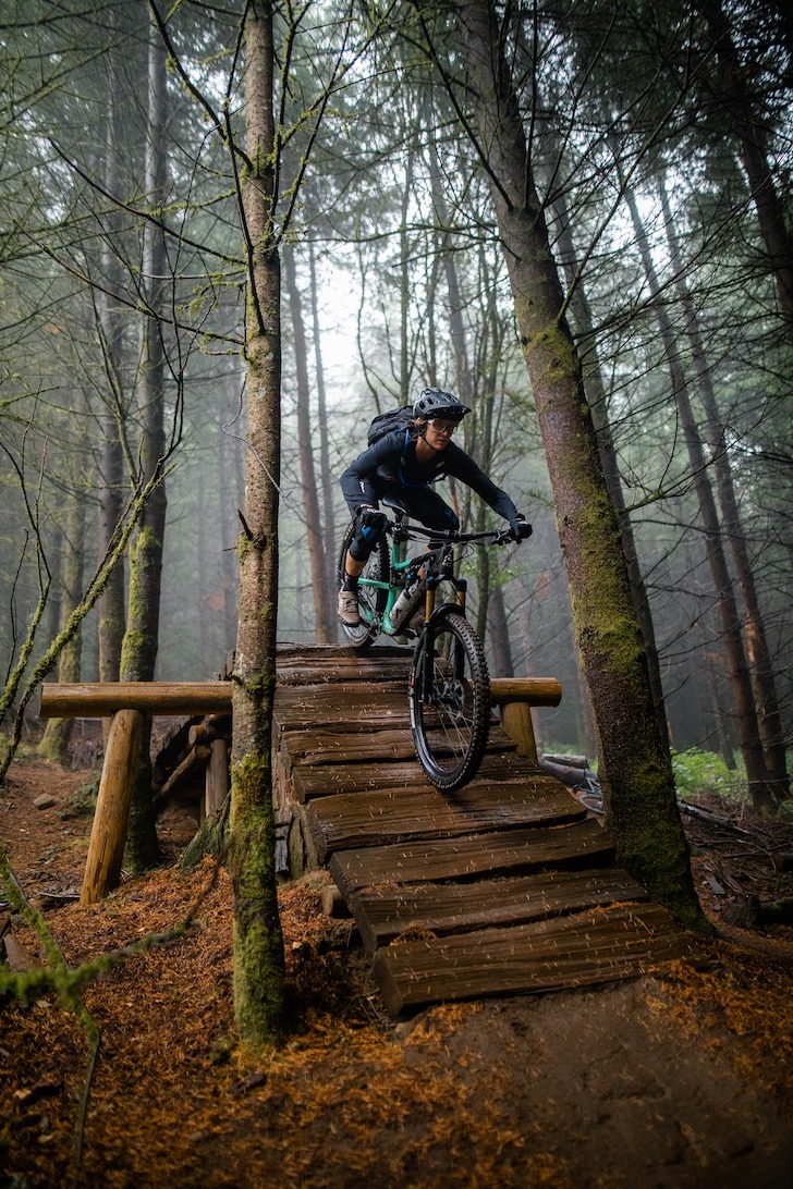
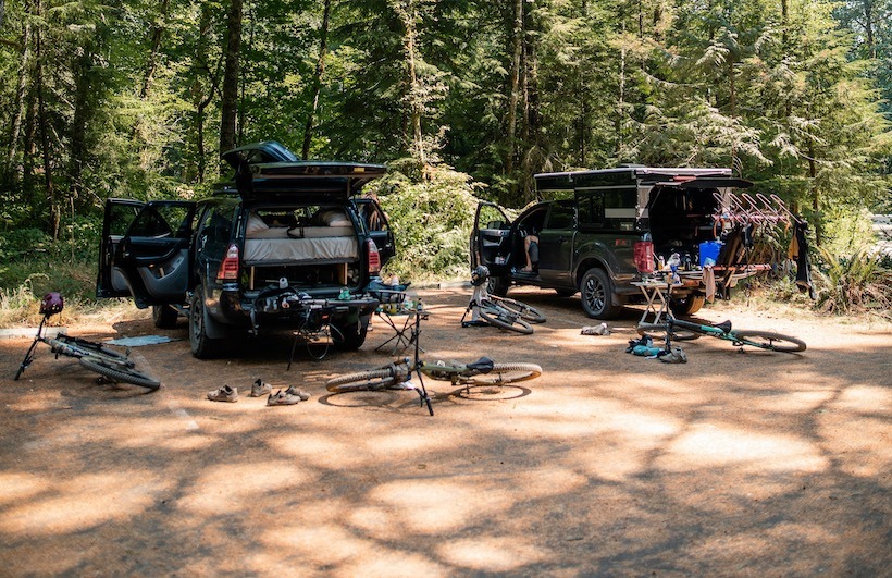
My partner Chris and I, along with our friends Kari and Chase, headed out on a 10 day mountain bike road trip through the Pacific Northwest. Our very first adventure in our new Project M Four Wheel Camper! The grand plan you might ask?…starting in Salt Lake, then making our way to Bend, and then through Hood River, Sandy Ridge, Portland, Bellingham, Leavenworth, Boise, and back home. Cruising our way from one rad mountain biking town to the next in our camper and we couldn’t be more stoked. We got the off-road camper installed about a month and a half ago, so with this being our first big trip in it, I must say it did not disappoint!!
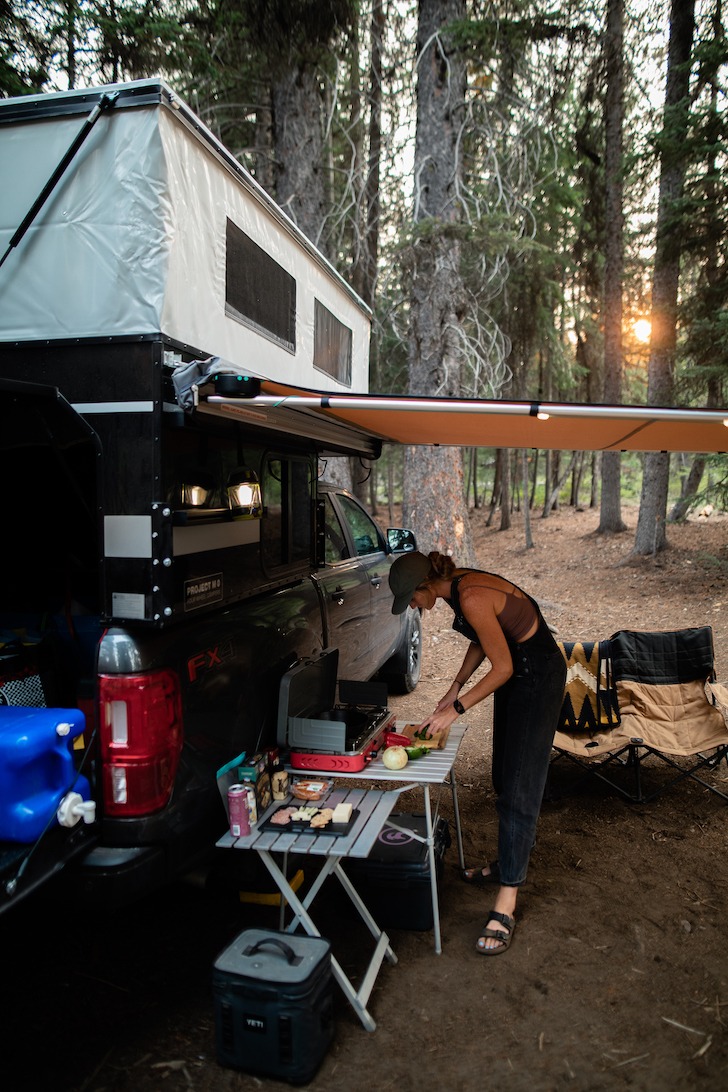
Out first stop, Bend, Oregon. Our friend sent us coordinates of a cool campsite right by the river, and when we drove up we were stoked to say the least! It was so nice being right on the river so that we could take morning and evening dips(even though it was freezing cold)… so more of a polar plunge or an ice bath you could say. It was the perfect little spot for us though, we cooked up some yummy veggie tacos on the grill and set up camp. Before we dive deep into this adventure, I first need to explain to y’all how nice it was having the Project M on this trip because it was a GAME CHANGER to say the least. It made traveling through the Pacific Northwest so comfortable and easy. The pop up tent itself was a breeze, it sets up in a matter of seconds, no joke. We also loved the locking back door so that we could put our gear in the bed of the truck and not have to stress about it. And of course, can’t forget about the queen size bed because it was a dream and we got the best nights sleep!!
After enjoying a night at camp and taking a morning dip in the river we headed over to Phil’s Trailhead to ride Upper + Lower Whoops. It felt so nice to get the legs moving and get a sweat on especially after sitting in a car for eleven hours driving the day before. It’s always fun switching it up and riding in a different place rather than your trails at home that you’re really familiar with. Upper + Lower Whoops was a good first ride of the trip, nothing too crazy but a really fun ride. For our second ride we sent it out on Tiddlywinks trail which unfortunately didn’t last long because a little over the bars action happened and we had to send it back into town to get a new brake lever. Which thank goodness we were able to find one or else that would have made the trip a loooonnggg one without it!! We were so grateful for helpful, willing people that stayed after hours to fix the bike!! Hallelujah and shoutout to Pine Mountain Sports. We were bummed that we didn’t get to ride as much as we would have liked to in Bend, but you know, sometimes that’s just the way it goes, and life happens. We knew we had a lot of biking ahead of us since we were only at the beginning of our trip. So we counted it and moved on to our next stop.
We headed north to Hood River. The drive from Bend to Hood River was insane with huge pine trees and windy roads and you can see Mount Hood while you’re driving so it’s beautiful. As far as mountain biking in Hood River, we rode in Post Canyon and man oh man it was such a good time!! To get up to the trailheads you wind through multiple neighborhoods and orchards which apparently, Hood River is known for their orchards. A local told us that 80% of pears in America come from Hood River, kind of crazy! We rode the trails Bad Motor Scooter to Grand Prix. Both are flowy jump trails and such a blast. Step ups, doubles, berms, you name it, these trails had it!
We tried to fit in as much biking as possible this trip, so we were only in each place for a couple nights sometimes only one night. After staying in Hood River one night we made a pit stop at Sandy Ridge on our way to Portland. Sandy Ridge is a mountain bike specific pit stop. The mountain biking there was unique in that you take the service road up as your climbing trail, and then you can lap things multiple times. The first trail we did was Flow Motion which was a proper flow trail with some tech. I LOVED this trail! I wish we had done it again because I honestly had the time of my life! Then we rode back up the service road all the way to the top to get a longer ride in. We dropped in at the top and did Rockdrop which honestly wasn’t our favorite. It’s a small loop that kind of takes you around and then back to the top and it’s not really worth it in my opinion. We then dropped into Upper Hide & Seek and oh my goodness….SO much fun!!! It’s traversy tech riding which keeps you on your toes and you always have to be choosing a line and staying engaged with the trail. When you get in the flow on one of these trails, it feels so damn good!! From Upper Hide & Seek we went into Lower Hide & Seek which was a blue flow trail – pretty mellow and fun! We finished off with TNT and Little Monkey – both are jump trails. TNT is a big jump trail that is only for advanced/experts and Little Monkey is a smaller jump trail which Kari and I took and it was a blast.
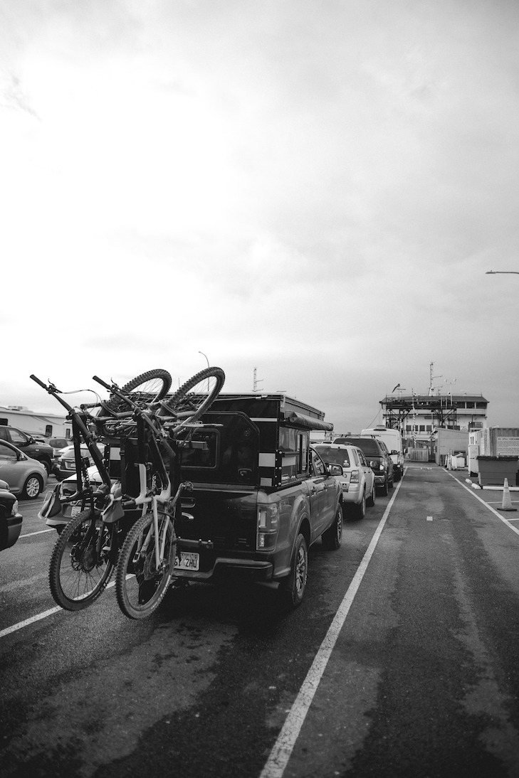
We then stayed in Portland that night with some family. We ate at this insanely yummy restaurant called The Bye and Bye which I would highly recommend if you’re in the area! The food was amazing and the drinks were so good!! We only stayed in Portland for a night and then went up to Port Townsend to take a ferry over to Whidbey Island. It was a little switch up from the biking which was nice to take a day off and experience taking our Four Wheel Camper on this massive ferry! I love that the Project M is big enough for our needs and feels spacious, but yet it’s not this HUGE camper that we’re towing or anything like that. With seeing so many different setups and campers on the road and on the ferry, it was a good realization for us that the Project M Four Wheel Camper was the way to go and that it’s the perfect size for what we need/want out of a camping setup. It’s minimal in a good way and doesn’t have all the extra froufrou… you know what I mean? We just wanted a comfortable space for camping and a place where we can put our gear, and the Project M does just that!
Onto Bellingham which was by far our favorite spot! The Pacific Northwest just brings such a different vibe than Salt Lake City. To start…it rains which sadly is few and far between for Summer’s in Salt Lake. And the mountain biking trails hold that rain so you get hero dirt which is just unreal to ride in! When we arrived in Bellingham it was misty and the clouds were low, your typical Pacific Northwest vibe you know!? We stayed in Bellingham for three days and rode our little hearts out. There was lots of hootin’ and hollerin’ to be had because the trails were just SO GOOD!!! There were a bunch of different trails in the Galbraith trail system, so I’m going to list them out so it’s easier for y’all to follow. Evolution – This trail had some really fun wood features, jumps, and doubles. It was by far one of our favorites and we did this one multiple times.Unemployment Line(or as we found out, as the locals like to call it…U line) – Big berms, jumps, good dirt! What more could you ask for!! We lapped this one multiple times as well. Mohawk – This is a big jump trail for advanced/experts! There are some big doubles so just make sure you scope before sending! Radical Dragon – Tech rocky rollers and some doubles Atomic Dog – A techy blue trail and Wonderland – Chill blue warmup trail.
The first day in Galbraith was just misty and then the second and third day it was full on raining and it was honestly pure bliss!! The stoke was HIGH! It was nice to be able to come back to the trailhead and hang our wet clothes in our Four Wheel Camper so that we weren’t just sopping wet. The Project M comes stock with one window, but we had the other window put in which was nice to open up and get some air flow. Especially while we were drying our clothes in the back it helped make it no so musty back there. Galbraith Trails and Bellingham were a dream and I can’t wait to get back there! But sadly, our time there came to an end and we headed to Leavenworth.
Leavenworth is a themed town which made it so fun. We were not expecting that, but it’s a full on Bavarian village. We stopped through here for a night making our way back to Salt Lake. We rode Rosie Boa which was some ridge line riding – a little bit of flow, a little bit of tech.
It was nice to be able to stop wherever and pop up the Project M if we needed to and the fact that we could still off road into some campsites and not be worried about it was really clutch. I can’t say enough good things about it!
Our last stop before heading home was Bogus Basin Bike Park in Boise, Idaho. We actually ended up just camping in the parking lot and popping up the camper and then waking up and riding for a few hours before heading back. This was my first time at Bogus Basin and it was so much fun. They have a good variety of trails there – tech, flow, advanced, beginner! Whatever you’re looking for, they’ve got it! G19 is their black tech trail to definitely hit up when you’re there.
All in all our trip was so memorable and amazing! I wish we had more time in each spot, but that just makes for a great excuse to get back to those places, right? We feel lucky to have been able to do it with our Project M because it made our camping seamless. Like I said, we’ve only had it for a month or so, so we haven’t had time to build out any portion of it yet, but we’re excited to make it our own as time goes on. We would love to create some sort of shelving system under the benches and maybe a folding table of sorts, but nothing too fancy, we like the minimalist vibe. We still did all of our cooking and camp chilling outside, we would just sleep inside which made it so that we could get a good nights rest. And we all know how much a good nights rest is needed while you’re biking that much!
Until next time folks! Sending all the good vibes and nature love:)
Check out more travels from Kait and Chris @Kaitvanhoff
Small towns with access to outdoor spaces often play host to visitors from all around the world. Whether tourists stay at hotels or eat at local restaurants, they are contributing to a community. When visiting the parks and trails just past the town, it’s important to bring that sense of community along for the ride.
Public land is something we all share. Whether you like to off-road, mountain bike, hike or camp, everyone has a duty to preserve parks and forests for the next trail user and for future generations. While we all have an individual stake in public land conservation, it is important to recognize the communities that share these spaces and work together to keep them open, healthy and beautiful. There are many ways to build and engage a community to protect these areas.
Here are a few tips to help create a bigger impact:
Talk to others who share the trails.
Join a recreation club.
Work with locals on stewardship projects.
Do your part by leaving an area better than you found it.
Use social media for more than just showing off your adventure — actively encourage others to help out.
Enthusiast groups and recreation clubs are some of the biggest supporters of public land conservation and stewardship. By joining a club or just supporting hosted public land stewardship projects, you can work together to keep a shared area clean and open. Check out a group’s social media or website such as Treadlightly.org to find events in your local area.
This is also a great opportunity to branch out and work with other recreation enthusiast groups who share the trail systems you use. All recreationists have a stake in public land conservation. Maybe you aren’t an off-roader, but you can work with a local Jeep club to repair a shared trail in your community. And you might just discover a new outdoor recreation passion in the process of helping out once you discover some of the stunning and remote places off-road vehicles can safely get responsible riders.
When visiting a region, remember to always protect it and leave it better than you found it. You are in another community’s backyard. The local communities near popular public land destinations thrive from tourism and have a stake in keeping these places open. Help protect public land by engaging with local businesses and individuals to support responsible recreation and stewardship projects.
During your travels, ask locals what issues they are seeing and try to proactively work to not further any damage in the area. By checking ahead of time with local land managers, you can find out if the area you want to visit is available and, if necessary, make a backup plan. Always remember the T.R.E.A.D. principles and be a good steward of your state’s public lands.
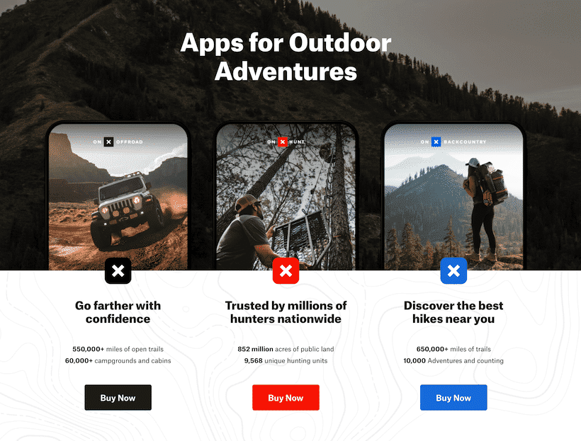
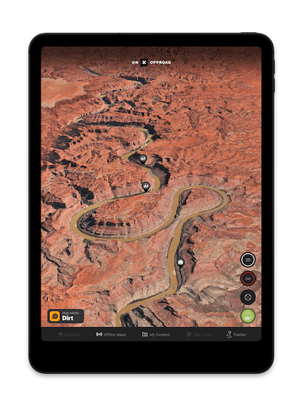
onX – Behind the Wheel: In this month’s BTW feature we sit down with the guys at onX Off-Road mapping software App and talk to them about their brand, how it works and how they see the future.
What’s the history behind the onX Brand/Platform?
onXis a pioneer in digital outdoor navigation. We bring outdoor experiences to life with our apps, so users can better find, safely experience, and later relive their adventures. Twelve years ago, onX was founded by an avid outdoorsman and Montana native to help hunters see public and private land boundaries in the field. We’ve since expanded our offerings to include apps for other recreationists who also have a high need for navigation. In 2019, we launched our onX Offroad app for off-road, overland, and Powersports enthusiasts. This year, we released our third app, onX Backcountry, built for human-powered adventurers–like hikers, backpackers, and backcountry skiers and splitborders.
Can you explain the App for our readership?
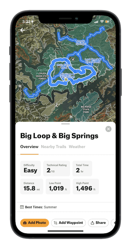
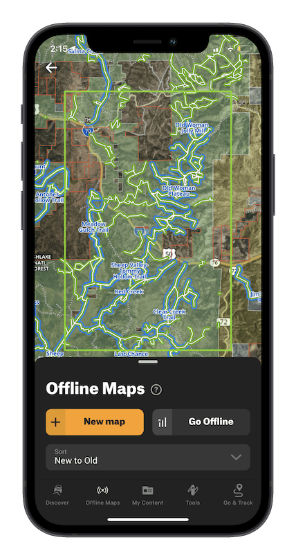
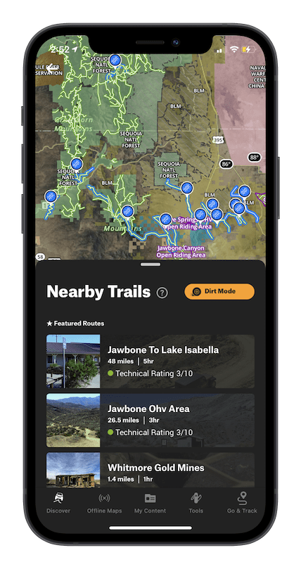
onX Offroad is the number one off-roading app on the market. When users open it up, they are instantly immersed in outdoor possibilities right on the map. At first glance, users have access to 550,000 miles of off-road trails–their difficulty levels, open and closure dates, and adventure details. The app also features public and private land designations, different map views, and over 500,000 recreation points, such as campgrounds, river access locations, trailheads, and even breweries. Users can download offline maps when heading out of cell service, and mark up the map with custom Waypoints, tracks, and photos to plan or remember a location for a later date. onX Offroad has everything you need to plan, execute, and remember an epic day on the dirt.
There are 4 specific platforms – any potential for a bundle?
onX’s apps are built specifically for their audience. onX Offroad is built by off-roaders for off-roaders, and when you call into customer support–you’ll talk to someone just as passionate as you are about the sport. That is true for the Hunt and Backcountry Apps as well. Right now, subscriptions to these apps are on an individual basis.
Who are your competitors and why are you different?
onX is designed specifically to make exploring by vehicle easier than ever before, allowing you to plan and execute a trip with less time learning a confusing app and more time enjoying the journey.
We do this better than our competitors because:
1. We invest heavily in quality trail information from reliable sources and have a dedicated off-road geospatial team (The Pit Crew) who reviews all featured trails. Therefore, you don’t waste time sifting through thousands of user-generated, and unverified trails that might have uncertain legality.
2. Because we’re designed for off-road exploration specifically, we put our trail data directly on the base map, so you don’t have to download it separately. Upon opening the app, all your off-road opportunities are illustrated in front of you (instead of a blank topo map). This makes it easy to identify regions to explore even places you’ve never been to before.
3. Instead of making customers filter through countless layers, we’ve done the work to combine everything from USFS and National Park maps to 4×4 guidebook content and campsites into three, easy-to-read base maps. You can even book fire lookouts and cabins, check the local weather forecast, or view active wildfires right from the map.
4. onX has a more comprehensive public and private land database than anyone on the market, making it easy to understand exactly where you are. Users just have to tap on the map anywhere in the country, and land management information pops up. This intuitive resource helps ensure that you’re recreating and camping where you’re supposed to be.
5. We care about keeping public lands open and preserving trails. In fact, onX has an Access + Stewardship teamdedicated to preserving the access we have to our public lands and advocating for more. Over the next few years, that team has committed to helping restore, secure or build 150 miles of trails and securing or improving public access to 150,000 acres of public land. We’re also hiring a Stewardship Manager to lead the charge in raising awareness about stewardship best practices in the off-road community. (TAP Editor’s comment: This is awesome to see – Thanks guys for taking Stewardship seriously!)
Do you have any up-coming features and initiatives we should be looking out for?
This summer, onX released a handful of new features and we’re looking to roll out a few more before fall:
Elite Membership: In addition to a Free Trial and a Premium Account, onX now offers an Elite subscription tier. Elite users have access to all the trails and features available in Premium, as well as access to private landowner information on their onX Offroad map. Private land data is an additional tool to aid off-roaders when out on the trail. If they’re riding on a friend’s property, for instance, they know exactly where it starts and ends. If they’re curious who owns the land next to the off-road park or are wondering about an easement that travels from public land, through private, and back to public land again–they know exactly where they are with onX Offroad Elite.
Updated3D: onX has released the next generation of its 3D maps for the Web App. This update features a richer and faster viewing experience and new functionality. Users can now see trails, all their custom markups (Tracks, Waypoints, and Lines), as well as public land designations, in 3D mode. Elite users can also view public and private land designations in 3D too. This is a key differentiator between our product and competitors; no one can even come close.
Go & Track: Finally, GPS navigation made for off-roaders.Go & Track provides a simplified, directional navigation view of the trail while driving.
Active Wildfire Layer: To help off-roaders make safer plans, onX is introducing a new Active Wildfire Layer. By pulling in data from the National Interagency Fire Center, users can see where these fires are burning on the map. A flame icon indicates an active fire, and boundaries are updated daily. This layer is available to all users, even non-paying subscriptions, as an important safety feature.
onX Offroad + Jeep: Two of the most trusted names in off-roading recently announced a collaboration with Jeep to empower more off-pavement adventures. Jeep Wave customers will receive six months of Elite access to the onX Offroad App. More details in this announcement are here.
With the increased use of trails, what are your thoughts on this, and how does your app fit into this in a positive way?
Outdoor recreation across the board has seen a huge boost in popularity recently, and off-roading is not immune to this trend. Through our app, we work to include information about each trail–including difficulty level, vehicle allowance, and open and close dates–to better inform folks heading out. By putting thousands of miles of trails right at their fingertips, we also work to provide a variety of off-road opportunities. So instead of hitting up the same popular trail someone is familiar with, we hope to arm them with the information and tools to confidently navigate to a new, less popular place, spreading out the impact on potentially over-loved places. We also use our platform to help spread stewardship messaging, working to educate everyone on how they can reduce their impact on our shared natural resources.
Let’s talk about your stewardship plans.
onX has a long history of stewardship and a passion for public lands. We have a team dedicated solely to improving our access and maintaining it through different projects. In the past few years, we’ve worked with land management officials to keep public land public, analyzed our mapping data to provide numbers that support a national call for public land funding, provided our own funding to improve public access in specific locations, and worked with organizations to help reduce our app users’ impact on the environment.
Entering the off-road space, we knew stewardship would be more important than ever before. No matter how you slice it, a vehicle has a bigger impact than foot or bicycle traffic, and that means we have a greater responsibility to mitigate that impact. This is not only vital for preserving the places we love to explore but also important to keep trails open for ourselves and future generations to enjoy.
While we can’t dive into our specific strategy for the future, I can address a few things we’re doing now. First, we’re hiring a full-time Stewardship Manager to lead the charge for onX Offroad. Their mission will be to raise awareness about our impact, teach people how to reduce it, and find new ways that our business, our customers, and the community as a whole can help save our trails and the landscapes they run through. Tackling these problems is a full-time job, so onX is treating it like one.
Even though this position hasn’t been filled yet, that doesn’t mean we’ve let off the throttle. Our Trail Guide team, who map the blue featured trails you’ve seen across the country, are introduced to Tread Lightly principles from day one. We make our stance clear in their onboarding process (See quote below) but more importantly require them to complete the Tread Lightly 101-course work online before submitting their first trail. This helps to ensure our team understands how to treat the trail system they’re mapping, and what trails should be mapped in the first place for a legal and sustainable trail network.
The app itself is also a tool to help promote stewardship. The first tenet of Leave No Trace is “Plan Ahead and Prepare,” and there’s a good reason for that. Having a trip plan and understanding what lies ahead ensures that you will be staying on legal routes with difficulty you can manage. That reduces the chances of going off-trail to avoid obstacles, driving over sensitive terrain, or encountering landscapes not suitable for your vehicle. You can use our ride type filter to make sure the trails you’re traveling are actually appropriate for your vehicle type and utilize the weather function to help predict if rain or snow might make the trail too soft.
Most importantly, the more trails we can show people the more we reduce the impact. That’s because the majority of enthusiasts only know of a handful of popular trails, which get overrun and overused–which could lead to closures. By showcasing a greater number of trails, we can help disperse that traffic over a much greater area, reducing the impact per trail to a sustainable level that will help prevent new closures. This is one of the reasons why the National Park, USFS, BLM, and one of our Trail Guides, Bill Creech, came together to add 660 miles of additional trail to the map in the Mojave. The new route segments are called the East Mojave Heritage Trail.
Chris Cordes – Trail Guide Manager onX
At onX Offroad, we have a deep-rooted passion for everything outdoors. Whether through four-wheel drives, bikes, or skis, we live to experience the wild places our planet has to offer—and it’s our goal to empower others to do the same. That’s why we’re constantly working to not only enhance our apps, but preserve the lands they help us explore.
We back ethical off-roading— following legal routes outlined by landowners and management groups, and always adhering to Tread Lightly and LeaveNo Trace principles. We strive for equal access for all people and all interests, balancing the need to preserve motorized use, with the critical conservation of wilderness areas for future generations.
It is our belief that by resourcing an intentional community of off-roaders with the knowledge and tools to stay on track even when they are off grid, we can help to reduce impact, limit closures, preserve habitats, and create a passionate community of outdoor advocates.
Where do you see the world of Off-road Recreation/Navigation going in the next 5 years?
We expect to see an increased interest in the outdoors and off-roading/Overlanding in general. And technology and geo-spacial information will keep accelerating as well. It wouldn’t be shocking to see up-to-date and verified trail information curated and readily available, similar to how snow conditions are reported at ski resorts.
Seasonal openings may shift based on a multitude of factors and snowdrifts or landslides can make trails impassable at unexpected times. That sort of open/closed data could be at your fingertips before you head down a trail, whether that is satellite-sourced data or information sourced directly from land management agencies. Mesh networks and wider cell tower (or satellite communication) coverage could also rapidly change how data is used while in the backcountry or to keep folks up to speed on conditions before they head out.
For more information on onX Off-Road Mapping App, check HERE