Our friends over at Planetary Design sent us their new Brutrek Ovrlndr French Press last week, so it was a great excuse to get away from our desks and sneak out for a one night mid week, camp out in the mountains to test it.
Brewing a pot of coffee on a cold morning camping, is a ritual we take very seriously here at TAP. Like most things, there’s so many variations on the theme, but for us we’ve been using the French Press method for a while now.
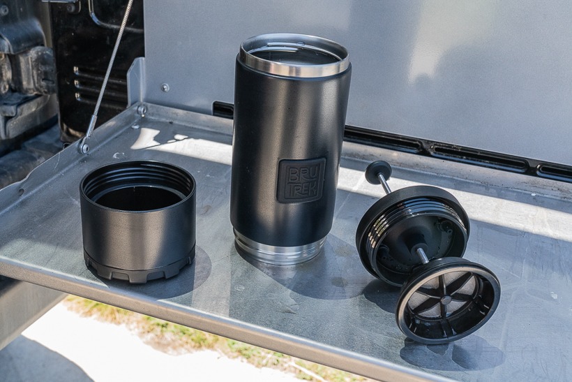
Out of the box you notice the build quality of the french press. It’s feels solid and durable in the hand and not like just another promo piece out of China. I particularly like the removable (unscrew-able) bottom for easy clean. This has always been a bugbear of mine, as the coffee granules always gets wedged in at the bottom, due to the pressure created from the press. It’s double walled and insulated stainless steel, so it kept our coffee warm as required. It also has a spill proof locking lid for easy access to the liquid gold inside.
Pros: Quality build and easy clean design.
Cons: For us coffee hounds, we’d like to see a bigger capacity version than the 24oz provided.
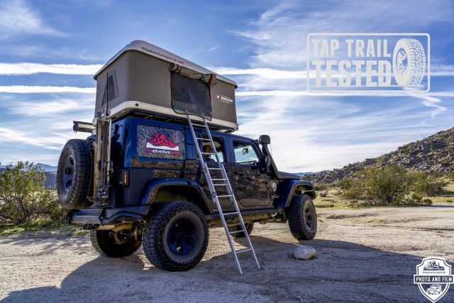
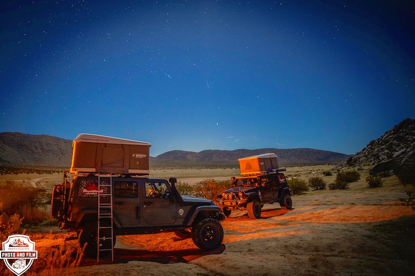
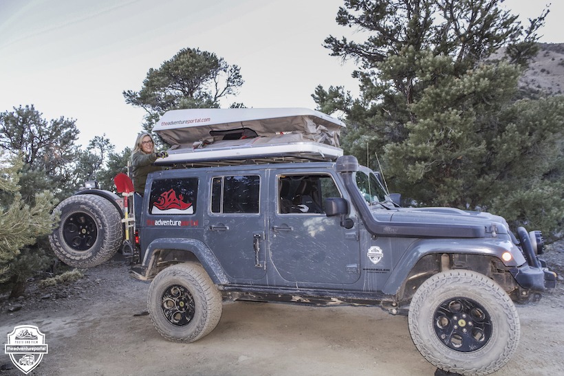
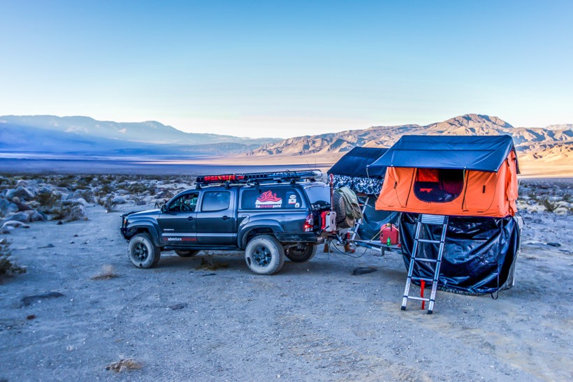
Here at TAP, we spend a significant amount of nights under the stars, in a variety of weather conditions across all seasons. Over the last decade, we’ve used off road trailers, ground tents, soft roof top tents, pop up truck bed campers and even slept in our rigs on a blow-up mattress. However, the past two years we’ve been using an Autohome Maggiolina Extreme hard shell RTT on each of our rigs. This model was originally designed and built for pre running the grueling Paris Dakar Rally so since we typically camp in all conditions, this model seemed a no brainer.
Roof top tents (RTT’s) have always been a staple of core overlanding and off-road adventure travel, however for years have been fairly unknown with mainstream campers. With the exponential growth of Vehicle Supported Adventure in the past few years, this is changing rapidly and we’ve seen a major growth of RTT brands on the market. Autohome is one of the originals: designed and built in Italy and remains one of the leaders.
MAGGIOLINA EXTREME SPECIFICATIONS:
Size: Small
Color: White/Light Grey (also comes in White/Carbon or Black Storm)
Exterior: 51”x83”x13”
Height: 34” mattress to ceiling.
Mattress: 48”x72”x3.2”
Weight: 143 lbs
Price: $3299
AESTHETICS, SIZE AND WEIGHT:
We chose the Small version of the Maggiolina Extreme as it fits perfectly on the Jeeps AEV roof rack and doesn’t hang out the rack and overwhelm the vehicle. It also proportions the size and weight across the whole rack, which helps with off road stability.
The Small is quoted as a two-person tent, but in our opinion, it fits one person very comfortably, but two people is somewhat of a squeeze. If you truly want/need a two person, we’d recommend moving up to the Medium version.
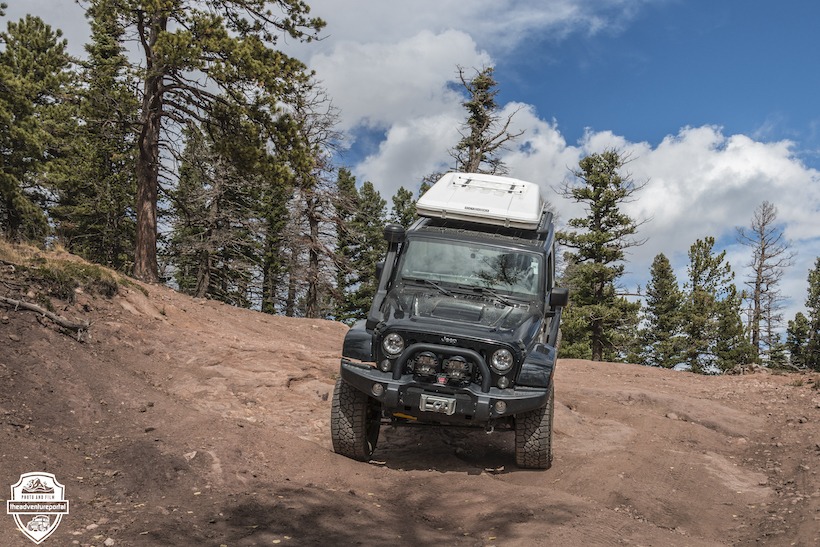
The overall shape is well thought out and is relatively aerodynamic. That being said, be prepared that putting any roof rack and RTT system on your roof, will create wind noise and lower your MPG’s. It also raises your center of gravity, lowering stability, so be cognizant of this when driving off road.
Regarding weight, the Small is 143 lbs (standard for most hard shell RTT’s) and at that weight, it’s likely to stay on your roof full time.
On the advice of the guys at Autohome, we went with the white shell with the grey fabric version. Their rational, which made perfect sense, was that with the amount of desert camping we do, we’d be significantly cooler with the sun reflecting white version. Personally, from a purely aesthetic point of view, I still prefer the darker stealthier grey or black shell colors. Not really a big deal, but when you’re paying over $3k, aesthetics definitely count in the decision process.
SET UP/TAKE DOWN:
This is where hard shell RTT’s really shine and the Maggiolina Extreme can be set up within a minute. After a long day on the trail, this is a true luxury and creates a certain smugness as you sip your first beer watching others deploy their ground tents or other energy sapping camp choices.
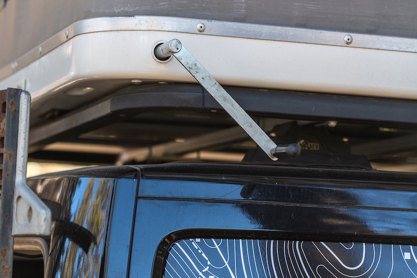
The Extreme uses a hand crank that raises the tent structure vertically by employing two sturdy scissor arms in the front and back. It’s definitely slower than the simple push up gas struts featured on many competitors, however there’s a real sense of rigidity and lack of potential sag. In our two years of use and hundreds of deployments, we’ve never had an issue.
The hand crank mechanism also helps significantly when stowing the tent. We find that stopping stowing with about 6 inches to go, allows us to easily tuck in all fabric that otherwise would become caught between the shells top and bottom.
We’ve never lost a crank, however have certainly driven off with it still located in the side of the shell (much to our horror!) Losing the crank would disable the ability to use the tent and because of this, we always carry a spare. A lost crank on a multi-day trip would be unthinkable!
STORAGE – INSIDE AND OUT:
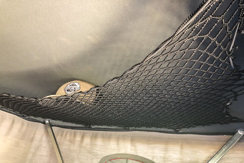
Storage within the Maggiolina Extreme is excellent. It comes with hanging mesh side pockets each side, that have ample room for storing keys, flashlight, pee bottle, ear plugs and everything else you may need. (I permanently leave ear plugs in them, guaranteeing a peaceful night when camping with fellow campers)
In addition to the side pockets comes a roof net that is perfect for larger items like shoes or camp sandals.
When closed and traveling on the trail the Maggiolina Extreme has room for a sleeping bag, under blanket, pillow and RTT ladder. As we travel in Jeeps with their compromised storage space, this has been an important feature. It also means that we never forget bedding (something that we’ve actually done in the past)
The Extreme’s roof is reinforced and the heavy duty scissor supports, allow the use of an integrated roof rack. When we got the RTT’S we thought this was a great idea, but honestly we’ve never used them. Probably because we’re on 35’s with 4.5” lifts, so maybe if we were on a lower vehicle they’d be more relevant.
COMFORT:
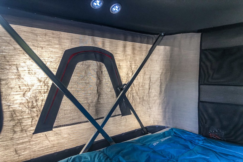
With the 3.5” memory foam mattress I generally find the Maggiolina Extreme very comfortable. It’s a relatively firm mattress which I like, even though I am a side sleeper. Others may want to add another layer of padding which honestly is common to all RTT’s that I’ve slept in.
I am 5’10” tall and I find that the scissor arms and track are fairly close to my head and toes. This isn’t a problem personally, but if you’re 6ft and above it’s worth checking out, especially if you sleep on your back.
Ventilation in a tent is essential in either warm or cold weather. The large roll up doors either side and windows each end, provide solid ventilation and I’ve never felt a lack of air flow. (It should be noted that other RTT designs do provide larger roll up and zip off mesh panels for potentially greater ventilation).
Condensation can be an issue with sleeping in any tent, however the combination of Dralon fabric and window vents seems to keep this at bay. In the two years of use, we’ve never had an issue.
Each door is equipped with a draft flap that tucks under the mattress to keep the wind out. This is something I didn’t appreciate until my first night in a storm and is a considerable improvement over many standard entrances.
Weather resistance has proved fantastic. We’ve camped in extremely high winds and driving rain and have yet to experience any ingress of moisture.
CONCLUSION:
Roof top tents are not inexpensive and without question a true investment into the Vehicle Supported Adventure lifestyle. At prices between $2500 and $4500 it’s important to understand what you’re paying for.
Our Autohome Maggiolina Extreme’s have truly been TAP TRAIL TESTED and have probably 5 years of heavy use all rolled into 1. To date, the tents shows no major wear in their fabric, shells or mechanism’s. A true testament to their build quality and design. No design or product is perfect, but we can genuinely recommend the Maggiolina Extreme (although I still wish we’d bought the Grey or Black versions).
What to look for when buying a Roof Top Tent, CHECK HERE
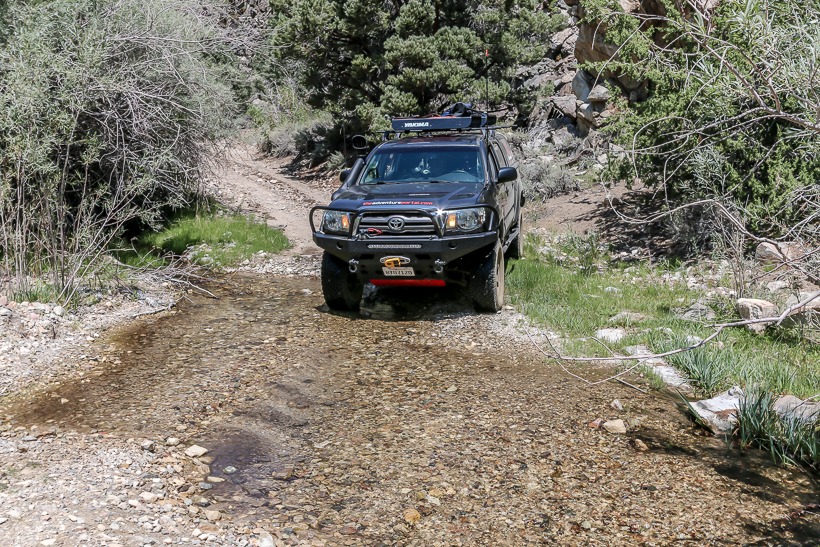
Easy to moderate (stream crossings likely moderate after seasonal runoff)
Required Vehicle
Stock 4×4 with high clearance.
Time
2-3 hours
Length
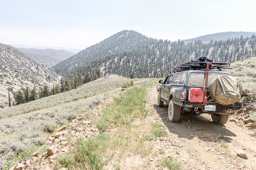
16.2 miles
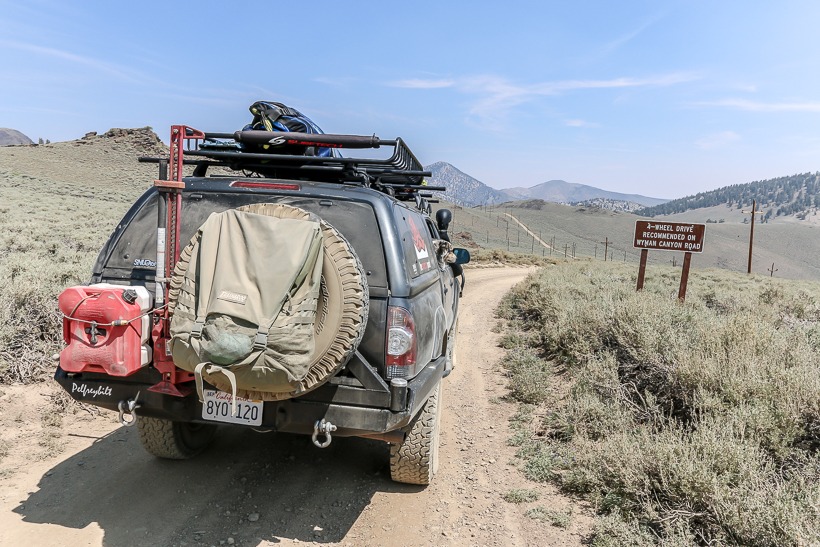
Trailhead-Wyman Canyon
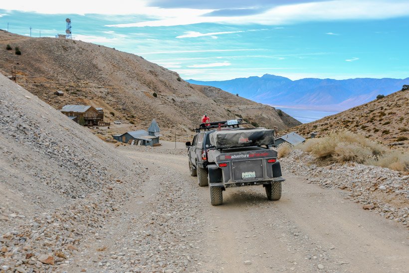
Directions: To get to the Wyman Canyon Trail take the White Mountain road, and the off-road trailhead is 3 miles past the Schulman Grove visitor center. Turn right (east) for Wyman Canyon Trail or left (west) for Silver Canyon Trail.
Mellow switchbacks
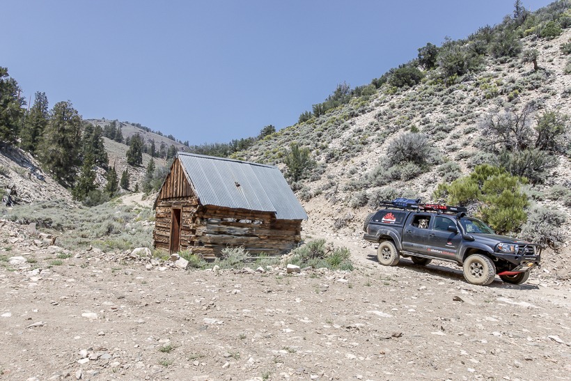
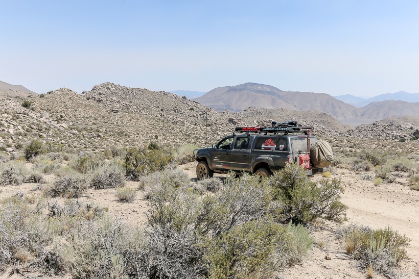
Site Location and Description: The overland worthy Wyman Canyon trailhead is at 10,500 ft with magnificent views west to the eastern Sierra. It is clearly marked and leaves the graded and easy White Mountain Road. The trail takes you winding down through gentle switchbacks into Wyman Canyon. In dry conditions, 4×4 is unnecessary for the first 7 miles. After this point, the trail starts to criss-cross the canyon’s stream multiple times. In summer, crossings are shallow and very mellow, however it should be noted that they could alter considerably in different seasons or after storms. After several miles of following the canyon and stream, the off road trail exits into an open boulder strewn high desert environment. At 16 miles, the trail ends and connects to the I-168.
Mid-point
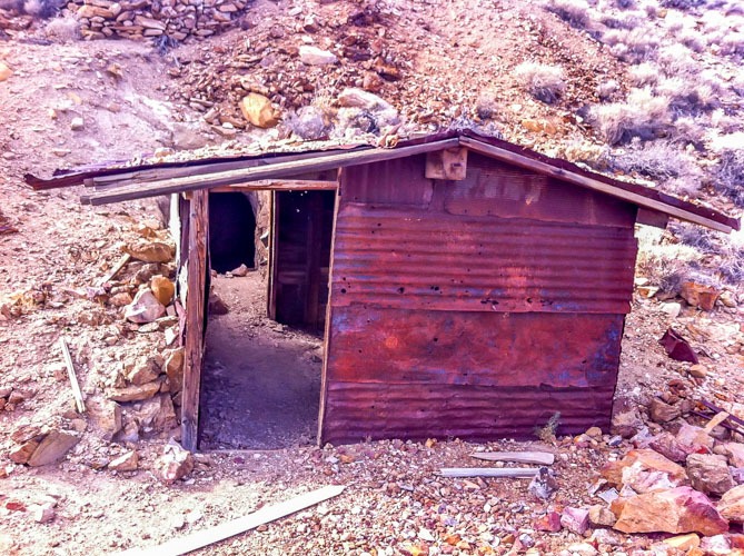
History of Wyman Canyon : This road follows Wyman Creek, an old mining and pole line road. On the East end of Wyman Canyon is White Mountain City. In the 1860’s, this was a silver processing town. Only some stone walls and smelter stacks remain.
TAP note: We drove this in August when the stream crossings were very mellow. There were, however, a couple of areas where we could see that the crossing would become significantly more challenging with increased stream flow. TAP always recommends that you take all safety precautions when crossing any body of water and respect the tread lightly principle of crossing slowly in order to disturb the natural ecosystem as little as possible.
Sagebrush desert in the canyon on Wyman Trail
Click here for more CA off-road, Overlanding trails…..and TAP into Adventure!
San Diego, Imperial, and Riverside Counties, California, USA
Nearest City
Borrego Springs and Julian
Coordinates
33°15′33″N 116°23′57″
Area
585,930 acres
Established
1933
Governing Body
CA Department of Parks and Recreation
U.S. National
National Landmark
Designated
1974
Phone
760-767-5311
Park Hours
Dawn until dusk in the day use areas of the developed campgrounds
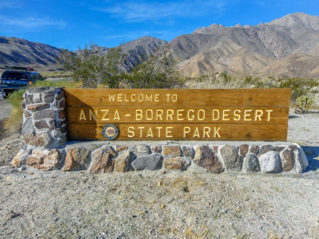
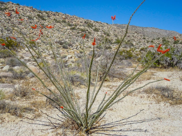
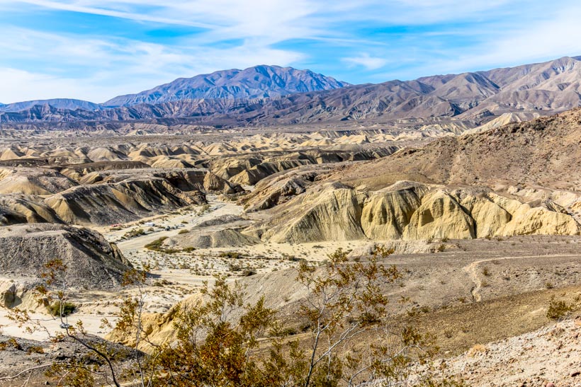
Location and site information: Anza-Borrego Desert State Park is located on the eastern side of San Diego County, with portions extending east into Imperial County and north into Riverside County. It is about a two-hour drive from San Diego, Riverside, and Palm Springs. Anza-Borrego Desert State Park is the largest state park in California encompassing over 600,000 acres. It contains 12 wilderness areas with many miles of hiking trails and some great high-clearance roads for the 4×4 enthusiast. The park is named for the Spanish explorer Juan Bautista de Anza and the Spanish word borrego, or sheep for the bighorn sheep that inhabit the park. This beautiful state park features washes, wildflowers, palm groves, cacti and sweeping vistas. You may also catch a glimpse of roadrunners, golden eagles, kit foxes, jack rabbits, mule deer and bighorn sheep as well as iguanas, chuckwallas and the red diamond rattlesnake.
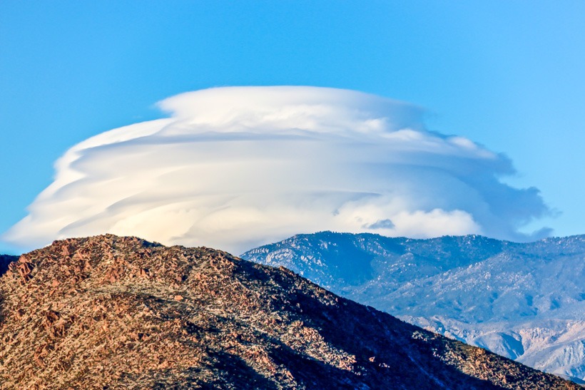
Anza-Borrego Desert State Park-Thunder cloud
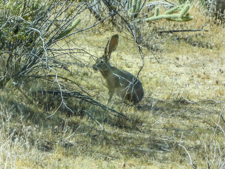
Anza-Borrego -Jack Rabbit
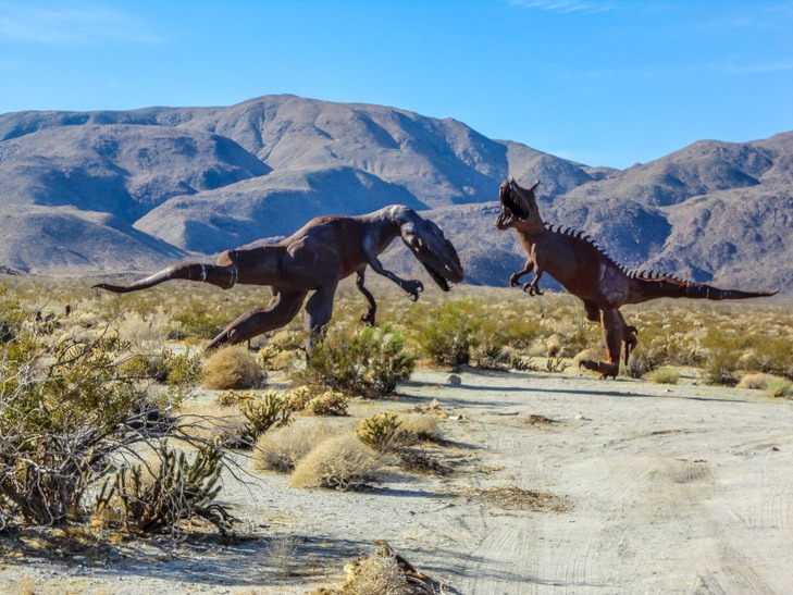
Some other sites in this area include over 130 world famous, full size metal sculptures of a vast array of creatures, pictographs; rock paintings drawn by the Kumeyaay Native Americans who lived in the Anza-Borrego Desert thousands of years ago, wind caves; formations created out of sandstone, a Kumeyaay Native American “village” of boulders (the Morteros Trail) with grinding bowls or morteros, slot canyons, an abandoned homestead on Ghost Mountain, a palm tree oasis (Borrego Palm Canyon Trail), a 20 foot waterfall (Maidenhair Falls in Hellhole Canyon), the site of an old calcite mine, and more. This is truly a family friendly destination. NOTE: Fire arms and fireworks are not allowed in the park.
Anza-Borrego Sculptures
Average temperatures: Average January temperatures are a maximum of 69.2 °F (20.7 °C) and a minimum of 44.0 °F (6.7 °C). Average July temperatures are a maximum of 107.3 °F (41.8 °C) and a minimum of 75.7 °F (24.3 °C).
The Visitor Center: The Visitor Center is located two miles west of downtown Borrego Springs (which is surrounded by the park) at the east end of Palm Canyon Road, just off County Road S-22. It has some very informative exhibits, plus the award-winning 15-minute film, A Year in the Desert. Hours of operation: October through May daily from 9 a.m. to 5 p.m. During the summer the Visitor’s Center is only open on weekends and holidays.
Ranger Nature Tours: Ranger-guided tours, lectures and campfire events are scheduled on a daily basis throughout the winter and spring. Check at the Visitor Center for schedules and don’t miss the flowers spectacular spring bloom!
Anza Borrego-cactus blossom
Accessibility: Most of the park’s facilities are wheel-chair accessible, including the main Palm Canyon campground.
Camping: There are four developed campgrounds with 175 total sites, and eight primitive overland campgrounds with even more places to camp. Primitive campgrounds are free, and sites at developed campgrounds range from fifteen to thirty-five dollars per night (and $80 for a group site at Borrego Palm Canyon Campground). There are vault toilets at the primitive campgrounds (except at Yaqui Pass), but not picnic tables or other amenities. Fish Creek Campground is the most developed of the off-road primitive campgrounds. Its six sites all have their own fire rings, which are not included at other primitive campgrounds. Blair Valley Campground is a large undeveloped area situated at 2,500 feet above sea level, providing more moderate temperatures than the desert below. Culp Valley is the highest primitive campground at 3,350 feet and Fish Creek is the lowest at 280 feet.
Campsites: Developed and Primitive
Developed Campgrounds
Season
Elevation
Fee
Sites
Water
Firerings
Toilets
Reservations
Borrego Palm Canyon
Year round
775 ft
$25-$80
122
yes
yes
Flush/shower
yes
Tamarisk Grove Campground
Year round
1,400 ft
$25
27
Yes. Non-potable
yes
Flush/shower
yes
Vern Whitaker Horse Camp
Year round
960 ft
$30
10
Yes. Non-potable
yes
Flush/shower
yes
Bow Willow Campground
Year round
950 ft
$15
16
yes
yes
flush
no
Primitive Campgrounds
Blair Valley
Year round
2,500 ft
$0
no
no
Vault in one area
no
Sheep Canyon
Year round
1,500 ft
$0
no
no
vault
no
Culp Valley
Year round
3,350 ft
$0
no
no
vault
no
Aroyo Salado
Year round
880 ft
$0
no
no
vault
no
Yaqui Pass
Year round
1,730 ft
$0
no
no
vault
no
Yaqui Well
Year round
1,400 ft
$0
no
no
vault
no
Fish Creek
Year round
280 ft
$0
6
no
yes
vault
no
Mountain Palm
Year round
760 ft
$0
no
yes
vault
no
Reservations and fees (prices are subject to change so call to verify), call 800-444-7275.
Day Use: the fee for day-use is now collected ONLY at Borrego Palm Canyon, Tamarisk Grove and the Vern Whitaker Horse Camp.
Groups require 6-month advance reservations; 7-day limit.
Roadside Camping is allowed. The rules are:
Do not camp further than one car length from any dirt or paved road
Do not camp within 100 feet of any water source
There is no garbage collection outside developed campgrounds so pack-in pack-out.
*Ground fires are not permitted, and metal containers must be used for all campfires
*This last rule is the trickiest. Bring a metal container to keep your fire off the ground. Pack out all coals, and dispose of them as trash. Coals should not be buried or spread out on the soil.
Pets: Dogs are welcome on leashes within campgrounds, but dogs are not allowed on trails or in wilderness areas. Overall, the desert is not a good place for dogs. Burned paw pads, cactus quills, and snakebites pose a danger to dogs, and canines threaten desert biomes as well. A dog’s scent can scare other animals away from trail areas, shrinking the habitat they rely on to survive.
Junction of Lippencott Road and Saline Valley Road
Location
CA and NV
Nearest City
San Bernardino, CA; Beatty, NV
Coordinates
36°14′31″N 116°49′33″
Area
3,373,063 acres
Established
1933 Monument/1994 Nat’l Park
Governing Body
National Park Service
Phone
760-786-3200
Visitor Center
Furnace Creek: open Nov.-April
Chloride City trail view looking SW
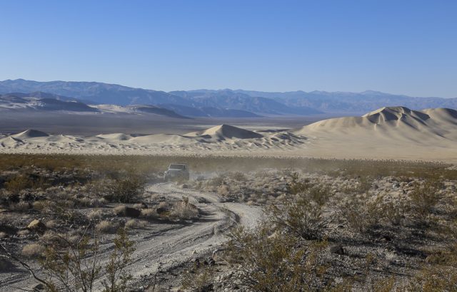
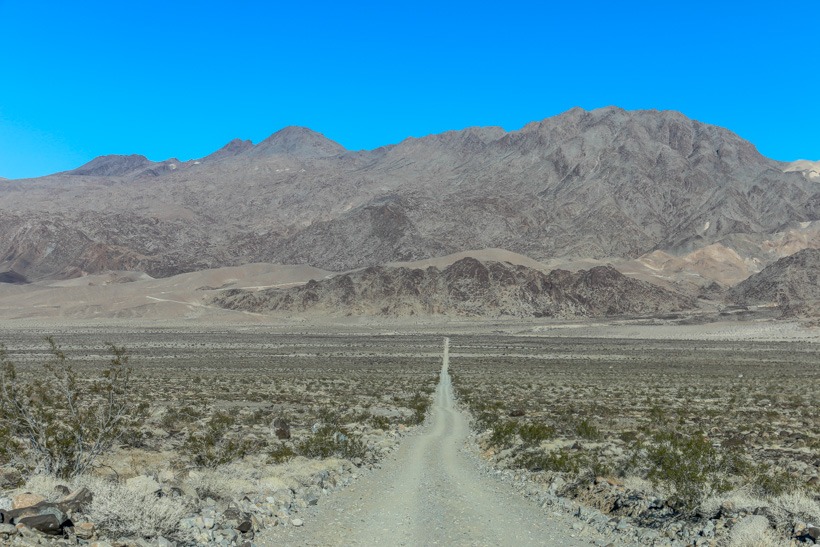
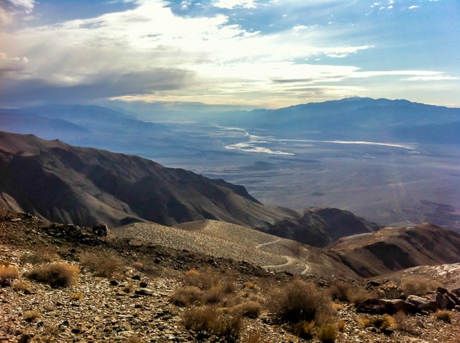
Site Location and Description: Death Valley National Park is located in the states of California and Nevada, east of the Sierra Nevada, spanning an area between the Great Basin and Mojave deserts. The park protects the north-west corner of the Mojave Desert and contains a vast array of desert environments: salt-flats, sand dunes, badlands, valleys, canyons, and mountains. It sits on the continental north American plate and was created by a complex series of tectonic movements. It contains faults that have occurred as the plate has stretched and moved. Geologists call this a pull-apart basin. The surrounding mountains rise as the valley sinks. These tectonic movements have created numerous lava flows and craters throughout the park. The Ubehebe Crater, on Desert Racetrack Road in the north-central part of the park is an example of this phenomenon. Within Death Valley lies the lowest point in the Western Hemisphere; Badwater Basin (-282 ft or 86 m below sea level) which is less than 100 miles away from Mount Whitney, the highest point in the United States. Death Valley is the largest national park in the lower 48 states and is an International Biosphere Reserve. Approximately 95% of the park is a designated wilderness area. It is the hottest and driest place in the United States.
Primitive camping in Saline Valley at the bottom of Lippencott Mine Road
Average temperatures: Temperatures from April-October range from the 90’s up to 120 degrees fahrenheit during the day and the 70’s to high 80’s at night. Temperatures from November to March range from the late 60’s to low 80’s during the day and the 40’s and 50’s overnight.
The Visitor Center at Death Valley National Park: The visitor center is located in the Furnace Creek resort area on State Route 190. A 12-minute introductory slide program is shown every 30 minutes. During the winter season, November through April, rangers offer interpretive tours and a wide variety of walks, talks, and slide presentations about Death Valley’s cultural and natural history. The visitor center has displays dealing with the park’s geology, climate, wildlife and natural history. There are also specific sections dealing with the human history and pioneer experience. The Death Valley Natural History Association maintains a bookstore specifically geared to the natural and cultural history of the park.
Death Valley National Park-Remains of Chloride City Mine
Camping: There are nine designated campgrounds within the park. Overnight backcountry camping permits are available at the visitor center
Campgrounds:
Campgrounds
Season
Elevation
Fee
Sites
Water
Fire pits
Toilets
Reservations
Furnace Creek
Year round
-196′
$18**
136
yes
yes
flush
yes
Sunset
10/15-5/1
-196′
$12
270
yes
no
flush
yes
Texas Spring
10/15-5/1
sea level
$14
92
yes
some
flush
yes
Stove Pipe Wells
9/15-mothers day week-end
sea level
$12
190
yes
yes
flush
yes
Mesquite Spring
Year round
1800′
$12
30
yes
yes
flush
yes
Emigrant Tents only
Year round
2,100 ft
$0
10
yes
yes
flush
no
Wildrose
Year round
4,100 ft
$0
23
yes
yes
pit
no
Thorndike*
March-November
7,400 ft
$0
6
no
yes
pit
no
Mahogany Flat*
March-November
8,200 ft
$0
10
no
yes
pit
no
* Accessible to high clearance vehicles only. 4-wheel drive may be necessary.
** RV Hook-up sites have an additional $12 Utility Fee that is not subject to Lifetime Pass discounts. Furnace Creek Campground becomes first come-first served and fee changes to $12 per night from mid-April to mid-October.
Reservations: For the Furnace Creek Campground and group sites: call 1-877-444-6777 or by go online at https://www.recreation.gov. All other campgrounds are first-come-first-serve.
RVs: Furnace Creek Campground has a few sites with full hookups for recreational vehicles. RV hookup sites are also available at the concession-run Stovepipe Wells RV Park and the privately owned Furnace Creek Ranch and Panamint Springs Resort.
Generator hours: 7 a.m. to 7 p.m.
Camping limits: Campsites are limited to no more than eight people and two vehicles or one recreational vehicle per site. Larger groups can reserve the group sites at the Furnace Creek Campground. The two group sites are limited to a maximum of 40 people and 10 vehicles each. No recreational vehicles may be parked at the group sites.
Campfires: All vegetation in the park is protected. Firewood and charcoal are available at the NPS Concession run Stovepipe Wells General Store, or at the Furnace Creek General Store. You can also bring your own. Fire pits or grates are provided at Furnace Creek, Texas Spring, and most of our other campgrounds. See the campground table above for specifics.
For a list of all TAP overland trail write-ups in Death Valley click HERE
Entering Cerro Gordo town from East
Death Valley Dream Lapse 1: Courtesy of Gavin Heffernan
For more Californian Overland and Off-Road Trails, Check Here
Directions: Joshua Tree National Park is located between I-10 and HW 62 in Southern California. It’s about 2-3 hrs from Los Angeles, 3-4 hrs from San Diego and 3-4 hrs from Las Vegas. Covering close to 800,000 acres, “J-Tree” straddles the transition zone between the Sonoran and Mojave Deserts.
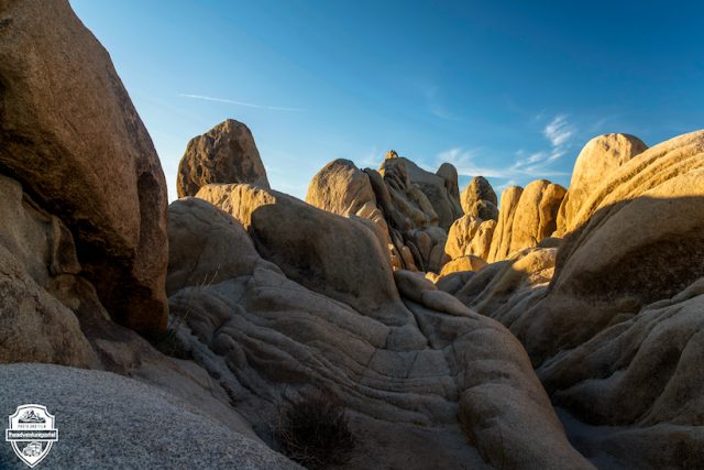
Site Description and Location: Though there are only a limited number of overland 4×4 trails, the park is a paradise for star gazers, rock climbers, hikers and photographers. Temperatures range widely across the seasons with searing highs in the summer and the potential for snow in the winter. Average temperatures are Jan 62F/30F, April 85F/50F, July 108F/71F and Nov 70F/38F. Camping is predominantly in 9 controlled sites, although registered backcountry hike-in camping is allowed. Obvious times to visit are spring and fall when the temperatures are the most moderate. Unfortunately, the park can get very crowded and only some sites are possible to book. The majority are first-come, first-serve; if you get skunked, there is an alternative primitive campground just outside the Cottonwood entrance in the southeast corner of the park. The Mojave zone of the park is the most widely used and is at an elevation of 3000 ft and above. It has a cooler climate than the Sonoran and has the classic large boulder formations and Joshua trees.
Joshua Tree National Park-Campground Information and Rules:
There are 9 campgrounds and nearly 500 campsites. Campsites are limited to six people, three tents, and two cars (a vehicle towing a trailer, popup, tent trailer, fifth wheel or a motorhome pulling a vehicle is considered two vehicles). Holding or reserving campsites for persons not present is not allowed, nor can campsites be left unattended for more than 24 hours. Group sites accommodate 10 to 60 people. Each campsite has a picnic table and fire grate. Water and flush toilets are available in Black Rock and Cottonwood campgrounds. Showers are not available.
Water is available at the Oasis Visitor Center, Indian Cove Ranger Station, West Entrance, and Black Rock and Cottonwood campgrounds.
Quiet hours are from 10 pm to 6 am. Generator use is limited to six hours a day: 7 to 9 am, noon to 2 pm, and 5 to 7 pm.
Food-storage containers capable of preventing access by wildlife are required. Any scented or odorous items must be similarly stored.
Campfires are allowed in the fire grates porvided. All vegetation in the park is protected. If you want to make a campfire, bring your own firewood.
RVs: There are no hookups for recreational vehicles. Black Rock and Cottonwood have fresh-water fill-up and dump stations. Motorhomes and habitable trailers are prohibited at Cottonwood and Sheep Pass group sites. At Hidden Valley and White Tank campgrounds, and at Indian Cove group sites, motorhomes and trailers, including their tow vehicle, cannot exceed a combined vehicle length of 25 feet.
Reservations: Sites at Black Rock and Indian Cove campgrounds may be reserved from October through May by calling 1-877-444-6777 up to six months in advance of the date you want to reserve. Or you may make reservations online at www.recreation.gov
First-come, first-served campgrounds: Belle, Hidden Valley, Ryan, and White Tank. Black Rock and Indian Cove campgrounds are first-come, first-served only during the summer-June through September.
Group Site Reservations may be made up to 12 months in advance throughout the year by calling 1-877-444-6777 or online at www.recreation.gov. Group campsites are available at Cottonwood, Indian Cove, and Sheep Pass campgrounds. Cottonwood and Sheep Pass group sites are limited to tent camping only.
Camping Limits: There is a 30-day camping limit each year. However, only 14 nights total may occur from October through May.
Overflow Camping: There is no overflow camping in the park, however there are some BLM areas nearby. Click here for a map (270k PDF). The park also offers backcountry camping.
Overflow Parking is not available in the park. All overnight vehicles must be parked in a designated campsite.
Questions About Camping call 760-367-5500
Campgrounds
Season
Elevation
Fee
Sites
Water
Horse Camp
Toilets
Reservations
Belle
Year round
3800 ft
$10
18
no
no
pit
no
Black Rock
Year round
4000 ft
$15
100
yes
$15
flush
yes
Cottonwood Reservation only
Year round
3000ft
$15/$25-40 group
62
yes
no
flush
no/group yes
Hidden Valley
Year round
4200 ft
$10
44
no
no
pit
no
Indian Cove
Year round
3200ft
$15/$25-40 group
62–3 group
no
no
pit
yes
Jumbo Rocks Reservation only
Year round
4,400 ft
$10
124
no
no
pit
no
Ryan
Year round
4,300 ft
$10
31
no
no
pit
no
Sheep Pass
Year round
4,500 ft
$25-40 group
6 group
no
no
pit
yes
White Tank
Year round
3,800 ft
$10
15
no
no
pit
no
Check out our Overland Trails section for more info on driving trails in Joshua Tree National Park.
Joshua Tree Journey Part 1: Video courtesy of Gavin Heffernan